This technology has become an integral part of modern society and is used by hundreds of thousands of organizations worldwide. They use GIS for a wide range of applications. It demonstrates how geoinformation technology helps us make more informed decisions, manage our environment sustainably, and tackle the challenges of the 21st century.
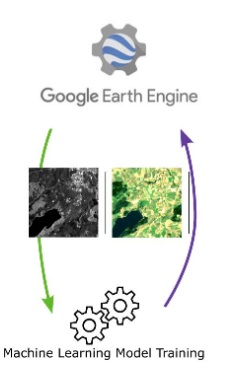
This two-day advanced Google Earth Engine course covers advanced topics such as vegetation indices and machine learning. Prior completion of the Google Earth Engine Basics course is required.
The Revolutionary Impact of GIS on Various Sectors
The influence of Geographic Information Systems (GIS) on various sectors is both profound and transformative. By visualizing and analyzing geodata, GIS unlocks new insights and efficiencies that were previously unattainable. This has led to innovative applications and improved decision-making across numerous fields.
- Environmental Management and Conservation: GIS plays a crucial role in monitoring ecological changes and managing natural resources.
- Urban Planning and Infrastructure: Urban planners and developers use GIS to identify optimal locations for new developments, analyze traffic flows, and efficiently plan and distribute public services.
- Health Care and Epidemiology: GIS enables public health experts to track the spread of diseases, identify hotspots of infectious diseases, and target vaccination campaigns where they are most needed.
- Agriculture and Food Supply: Agronomists use GIS to assess soil quality, optimize crop yields, and promote sustainable agricultural practices.
- Emergency Relief and Disaster Management: In times of crisis, GIS provides essential information for coordinating emergency relief, assessing damage, and planning reconstruction.
GIS’s ability to present complex data in a visually appealing and insightful way not only enhances decision-making but also creates a platform for collaboration and communication among various stakeholders and sectors. By sharing data and collaborating on geographic analyses, organizations can solve complex problems and effectively communicate the results.
In addition, the ongoing development of GIS technology—such as integration with the Internet of Things (IoT) and the application of artificial intelligence—drives new innovations and improves operational efficiency across a wide range of industries. This underscores how the adoption of GIS technologies acts as a catalyst for change—not only in how we perceive and understand the world, but also in how we interact with and respond to our environment.
How GIS Contributes to Sustainability and Nature Conservation
GIS’s contribution to sustainability and nature conservation is both multifaceted and crucial. It provides us with the tools to better understand, protect, and restore our natural environment. Here are some ways GIS supports these goals:
- Identification of Critical Areas: GIS makes it possible to accurately map vulnerable ecosystems, such as wetlands and forests. This is essential for preserving biodiversity and protecting endangered species.
- Monitoring Changes: By tracking changes in land use and natural habitats over time, policymakers and conservationists can develop and implement effective conservation strategies.
- Natural Resource Management: GIS helps manage natural resources, such as water and forested areas, sustainably by providing insight into their current state and potential risks.
- Analysis of Environmental Impacts: GIS facilitates the evaluation of the impact of human activities on the environment.
A vision for the future presented by Wageningen University demonstrates that integrating nature into urban environments and protecting our coastlines through nature-friendly solutions—such as flower-filled dikes and wildlife corridors—is not only possible but also essential for a sustainable future.
The European Environment Agency emphasizes the urgent need for action against climate change and biodiversity loss. GIS plays a role in this by collecting and analyzing the data needed to formulate and implement policy.
Europe’s natural environment is under pressure, but the use of GIS in documenting, analyzing, and planning conservation actions offers hope. By collecting data on habitats and species, we can develop strategies to restore biodiversity and ecosystems. This aligns with Europe’s commitment to a green and sustainable future, as outlined in the European Green Deal and the Biodiversity Strategy for 2030.
What will you learn in the Advanced Google Earth Engine Course?
In-Depth Analysis of Vegetation Indices and Their Applications
Vegetation indices (VIs) are an essential tool in precision agriculture and environmental sciences. The Normalized Difference Vegetation Index (NDVI) is the best-known and most widely used index. NDVI helps identify areas of vegetation and assess their condition by utilizing the differences in reflectance between the red and near-infrared (NIR) spectral bands. Living green plants absorb a lot of light in the red spectrum for photosynthesis and reflect more in the NIR spectrum. This property makes it possible to determine the health and density of vegetation using satellite imagery or drone photos.
Different VIs have unique applications, depending on the desired insights:
- NDVI & NDRE: Often used to measure biomass and chlorophyll content in leaves. This is essential for determining the health of vegetation.
- SIPI2 & LCI: Indices focused on pigment and chlorophyll content in areas with full leaf cover.
- TGI & VARI: Useful for detecting chlorophyll sensitivity and leaf cover using RGB indices. Helpful for monitoring plant health in areas with high leaf cover.
Advanced software such as Pix4Dfields offers a range of predefined VIs such as NDVI, NDRE, VARI, and MCARI. This software also provides tools for creating custom index formulas that better align with the specific needs of crop surveying or crop protection. These features facilitate the interpretation of collected data, enabling the optimization of precision agriculture practices for better crop management and higher yields.
These indices and technologies play a crucial role in managing agricultural activities and protecting natural habitats by enabling a detailed analysis of vegetation patterns and health. This contributes to more sustainable practices by supporting targeted interventions. This reduces waste and increases the efficiency of natural resource use.
Machine Learning Techniques Applied to Environmental Monitoring
The integration of machine learning (ML) into environmental monitoring is revolutionizing how we understand and address climate change and its effects. By analyzing complex datasets, ML models can recognize patterns that are invisible to humans, making predictions about environmental changes more accurate. Here are some applications:
- Satellite Image Analysis: For detecting changes in land use, deforestation, and the health of ecosystems.
- Weather forecasting: Improving the accuracy of climate models.
- Biodiversity conservation: Identifying threatened habitats and species by monitoring changes in the natural environment.
These techniques enable us to respond more proactively to environmental threats and support more sustainable development practices.
Why Choose Our Advanced Google Earth Engine Course?
This advanced course in Google Earth Engine stands out for its in-depth focus on geoinformation technology and its practical application in environmental and Earth observation projects. Participants not only learn the theoretical foundations but also gain hands-on experience with real-world datasets. Key highlights:
- Expert Instructors: Learn from experienced professionals in the field.
- Practical Approach: Direct application of learned techniques to real-world projects.
The course offers a unique opportunity to expand and deepen your skills. Essential for anyone looking to accelerate their career in geoinformation.