
Vision

- Humanity faces major challenges because the Earth is undergoing significant changes.
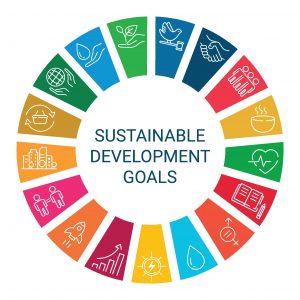
- A robust geoinformation infrastructure is vital to achieving the UN’s Sustainable Development Goals by 2030.
- Around the world, there is a growing need for people to gather, collect, process, edit, and analyze geoinformation.
- GIS, GeoAI, and Geo-ICT are used in all sectors. Thousands of people are needed, and these individuals deserve a pathway into the field and a strong start through high-quality courses and training programs.
Mission
 The field and science of geodesy measures the size and dimensions of the Earth, its orbit and orientation in the universe, and the gravitational field—and, consequently, sea level. The field is experiencing renewed interest, and we publish, communicate, and provide information on these topics. We offer various surveying courses on a monthly basis.
- We keep pace with innovative developments in Geo-ICT—such as 3D CAD, 3D GIS, the Internet of Things, continuous sensors, drones, data analysis, and 3D scanning—and are constantly updating and improving our course catalog. Our catalog contains more than 200 to-the-point, practical, and immediately applicable courses and blended learning programs.
- We are involved in the UniGIS program at Vrije Universiteit Amsterdam.
- We assist higher vocational education (HBO), secondary vocational education (MBO), and high schools in incorporating CAD, GIS, surveying, and hydrography into their curricula.
- We continuously hire graduates from universities of applied sciences and research universities across all fields of study. We provide these trainees with further training and help them get a strong start in the job market.
- Our clients hire our trainees, creating a win-win-win situation: the trainee, the client, and us as the training provider.
Geo-ICT’s Sustainability Pledge
At Geo-ICT, we pledge to use our expertise in geoinformation to actively support sustainable development. By offering hands-on training, we equip professionals with the skills to use GIS technology to monitor, protect, and improve our living environment. We are committed to the United Nations Sustainable Development Goals and see it as our responsibility to contribute to solutions for climate change, biodiversity, and a livable future through knowledge sharing and innovation.