Our diverse range of courses in the field of the Internet of Things reflects our commitment to equipping professionals with the knowledge and skills needed to integrate sensor data, geoinformation, and modern data architectures. Whether you want to learn how to build your own IoT sensor and collect data, or understand the entire chain from sensor measurement to map application, we have a course that fits your needs. The Sensor Network with Arduino ESP32 and Python course offers a practical foundation in working with sensors, microcontrollers, MicroPython, and data streams. For those who want to make the leap from measurement to geographic applications, the course From Sensors to Maps is ideal, as it teaches you how sensor data is enriched with location and made available as GeoJSON for use in maps and geo-applications. By linking these courses together, we ensure that you not only learn how IoT technology works, but also how to apply it in practice within geoinformation and data-driven applications.
The Role of the Internet of Things in Our World
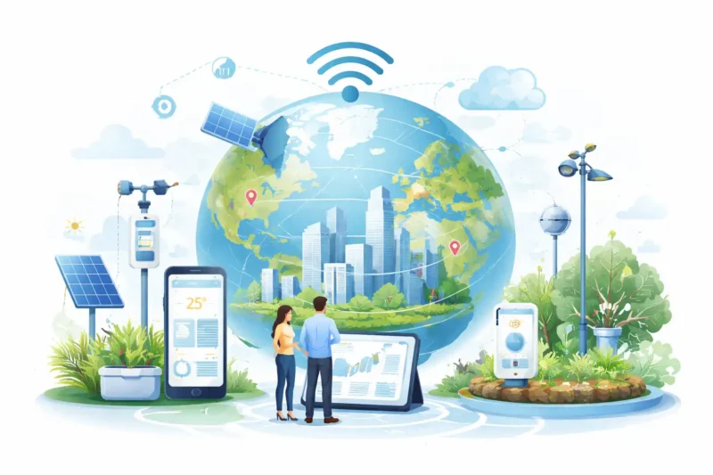
The impact of the Internet of Things on our world is significant and continues to grow. More and more devices, objects, and systems are collecting data about the physical environment and making this information immediately available for analysis and decision-making. From a geoinformation perspective, this is particularly valuable because much of this sensor data can be directly linked to a location.
Sensors make it possible to continuously monitor processes in the physical world. This creates a more up-to-date and detailed picture of what is happening in an area, a city, or an infrastructure network.
- Sensors measure real-time data such as temperature, air quality, noise, movement, or soil moisture.
- IoT systems enable this data to be automatically transmitted via networks and stored centrally.
- Combined with location data, this creates a powerful source of geodata for maps, dashboards, and analyses.
These developments underscore how important IoT has become for modern data infrastructures. By using sensors, microcontrollers, and APIs, organizations can respond more quickly to changes in the physical environment and make better-informed decisions. Consider, for example, applications in smart cities, environmental monitoring, infrastructure management, and logistics.
In addition, IoT makes it possible not only to view individual measurements but also to recognize patterns and trends. When sensor data is combined with geoinformation, a richer understanding of spatial processes emerges. This allows organizations to better understand where problems arise, how situations develop, and which measures are most effective.
Understanding the role of the Internet of Things is therefore relevant not only for technology specialists but also for professionals working with geodata, monitoring, spatial analysis, or digital infrastructures. Our courses are designed to show you both the technical fundamentals and the practical applications, so you can contribute to data-driven solutions yourself.
Innovative Applications of the Internet of Things
The Internet of Things offers a wide range of innovative applications that are becoming increasingly important in the world of geoinformation and digital systems. Using sensors, microcontrollers, networks, and backend platforms, physical processes can be translated into usable digital information. Some examples of how IoT is used:
Smart city monitoring: Sensors can be used to collect data on traffic, air quality, noise, or crowd levels in public spaces.
Environmental monitoring: IoT makes it possible to continuously measure and analyze environmental factors such as temperature, humidity, or soil moisture.
Infrastructure management: By connecting sensors to objects and installations, organizations can monitor assets and respond more quickly to malfunctions or maintenance needs.
These applications demonstrate that IoT is much more than just connected devices. It involves setting up complete data chains in which measurements from the physical world are collected, processed, and translated into insights. By delving into our courses, you’ll gain insight not only into the basic principles of sensor technology and IoT architectures, but also into how to apply this knowledge in concrete geo- and data solutions.
Furthermore, our courses encourage a practical and inquisitive approach to learning. You’ll learn not only how sensors function, but also how to make data usable for analyses, visualizations, and applications. This means you’ll gain insight into the interplay between hardware, software, and geodata, and learn how to integrate these components into a functioning system.
By enrolling in our courses in the field of the Internet of Things, you will develop skills that are becoming increasingly important in a world where real-time data and spatial insight are central. This will ensure you are well-prepared to contribute to innovative applications where sensors, networks, and geoinformation converge.