In urban areas, the effects of climate change are becoming increasingly apparent. Heat waves, localized flooding, and significant temperature variations within a single city require accurate and high-resolution measurement data. Traditional meteorological monitoring networks are valuable for this purpose, but often do not provide enough detail to accurately capture local variations. This is precisely why personal weather stations and IoT sensors are playing an increasingly important role in modern climate analysis.
In this course at Geo-ICT, you’ll learn how data from personal weather stations and sensor networks can be collected, verified, and processed into usable spatial information. You’ll gain insight into the quality of sensor data, learn to identify anomalies, and discover how to use GIS to analyze patterns relevant to urban climate research and climate adaptation.
Knowledge of GIS is not required, but it is recommended. Those with little experience with geographic information systems can take our basic QGIS course beforehand to familiarize themselves with the most important features.
The Importance of Personal Weather Stations for Urban Climate Research
The use of personal weather stations is growing rapidly worldwide. Individuals, organizations, and municipalities are increasingly collecting local weather data via compact sensors and online platforms. This development offers new opportunities for urban climate research, as measurements at the street or neighborhood level are becoming available. This allows local differences to be studied much more effectively than with official weather stations alone.
This data is valuable for, among other things:
- Analyzing heat islands: temperature differences between paved and green urban areas are made visible.
- Monitoring microclimates: local variations in temperature, humidity, and precipitation can be tracked in detail.
- Supporting climate adaptation: governments and planners gain better insight into where measures such as greening or water retention will have the greatest impact.
In this course, you’ll learn not only why this data is relevant, but also how to use the information responsibly in analyses and maps.
The Role of GIS in Analyzing Crowdsourced Meteorological Data
GIS plays a central role in processing and interpreting crowdsourced meteorological data. Individual measurement points from weather stations only become truly meaningful when they are analyzed spatially and combined with other geographic data. Think of land use, building density, green spaces, elevation data, and paved surfaces.
With GIS, you can:
- Visualize measurement points on a map: this gives you immediate insight into spatial distribution and local variations.
- Perform spatial analyses: for example, apply interpolation to estimate temperature or precipitation patterns between measurement points.
- Combine data with urban characteristics: this allows you to establish connections between climate data and urban design.
The course demonstrates how GIS helps transform raw sensor data into usable climate information for research, policy, and practical applications.
What You’ll Learn in the Microclimate Analysis with Weather Stations and GIS Course
Collecting and Evaluating Weather Station Data
An important part of the course is learning to work with data from personal weather stations and IoT sensors. You’ll learn about the origins of this data and how it can be made available for further analysis via platforms, exports, or API integrations.
We place a strong emphasis on data quality. This is because personal weather stations are not always located in meteorologically ideal spots. For example, sensors may be mounted on roofs, balconies, or in direct sunlight, which can skew measurement values. That is why you will learn to:
- How to identify anomalous measurements—such as those caused by incorrect placement or technical malfunctions.
- Apply basic quality control: so that only usable measurement data is utilized.
- Preparing measurement data for GIS analysis: including structuring, cleaning, and linking to location data.
Spatial Analysis of Microclimates
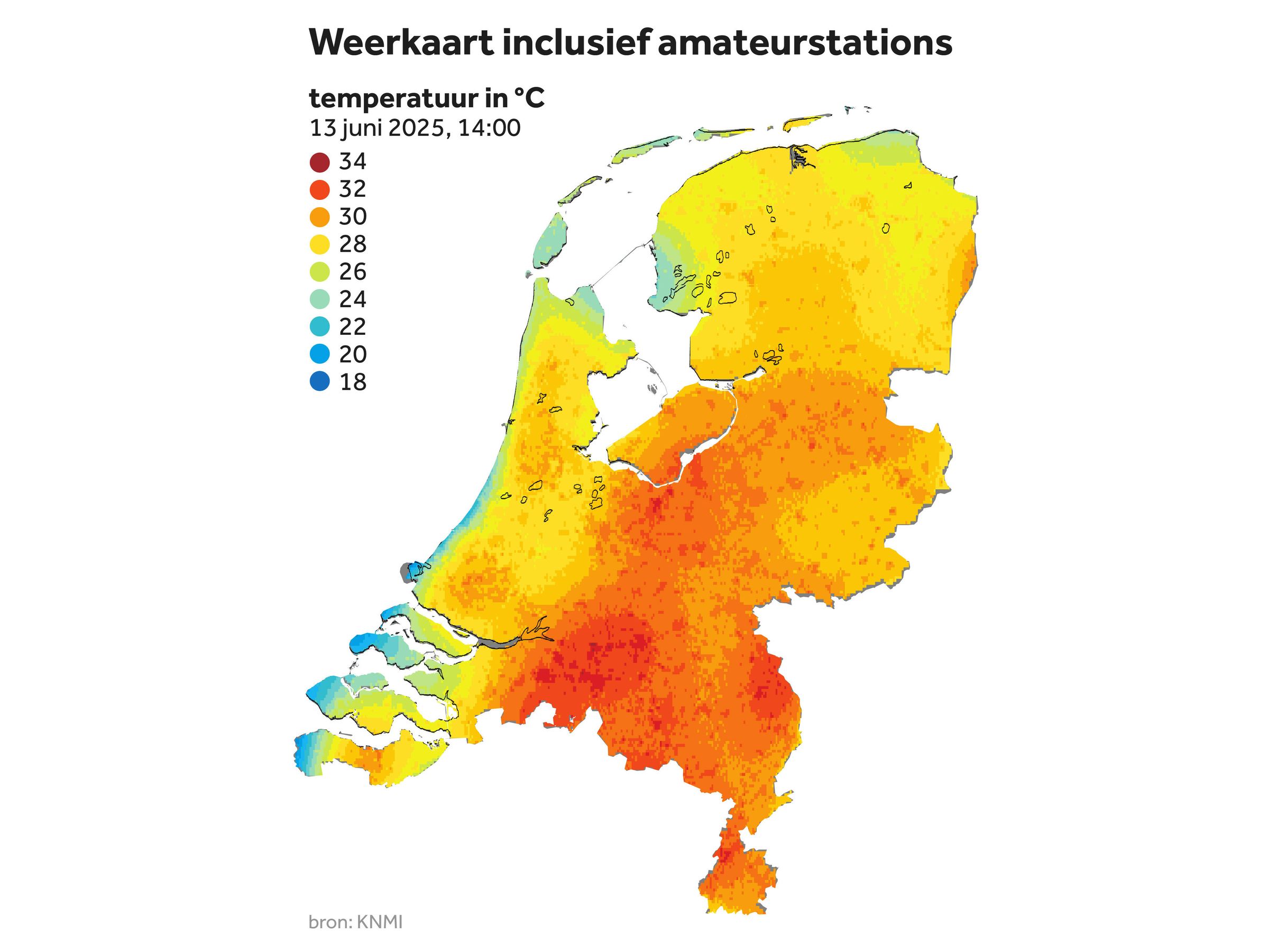
Once the data has been prepared, you’ll get to work on spatial analysis. Here, you’ll learn how point data from weather stations can be converted into maps that visualize urban temperature and climate effects. The course covers, among other things:
- Interpolation of measurement data: such as creating temperature maps based on scattered measurement points.
- Analysis of spatial patterns: for example, differences between paved, green, and water-rich areas.
- Microclimate mapping: focused on visualizing local climate effects within cities and neighborhoods.
Through this course, you’ll learn how to use GIS to gain valuable insights from sensor data that would otherwise remain fragmented and difficult to interpret.
Applications for Climate Adaptation and Urban Planning
The course focuses explicitly on the practical application of these analyses. The information from personal weather stations and GIS can be directly applied to issues related to climate adaptation and urban development. You’ll learn how this data can contribute to:
- Heat stress maps: to identify vulnerable locations.
- Analysis of the impact of green spaces and water: for example, on urban cooling.
- Justification of adaptation measures: such as greening, shade structures, and stormwater management.
In this way, the course bridges the gap between technology, geodata, and concrete challenges in urban practice.
Why choose our Microclimate Analysis with Weather Stations and GIS course?
At Geo-ICT, we combine practical knowledge of GIS, sensor data, and spatial analysis with current topics such as the urban climate and climate adaptation. This course is designed for professionals who want to look beyond standard weather data and specifically need local, high-resolution climate information.
Here are a few reasons to choose this course:
- A current and future-oriented topic: the combination of GIS, IoT, and climate adaptation is becoming increasingly relevant for research and policy.
- Practical approach: You’ll work on realistic applications related to microclimates, urban heat, and sensor data.
- Immediately applicable knowledge: the course provides practical tools for use within municipalities, consulting firms, smart city projects, and climate research.
Through this course, you’ll not only develop technical skills but also gain a better understanding of how crowdsourced meteorological data and personal weather stations can contribute to a climate-resilient living environment.