At Geo-ICT, we understand that Earth observation is a multifaceted field full of possibilities. Whether you’re fascinated by the potential of drones in geoinformation or want to explore the unprecedented possibilities of the Copernicus Program, our course offerings cover all the bases. Take, for example, our Drone Survey Course, where you’ll learn how drones can be used for accurate land surveying and aerial observations. Or dive deeper into the world of satellite data with our Copernicus Program course, which gives you insight into how this European initiative contributes to environmental and safety management. And for those interested in the technical aspects of data collection and analysis, our Remote Sensing course offers a thorough exploration of sensor technologies and data interpretation.
Each course is carefully designed not only to expand your knowledge but also to develop practical skills that are immediately applicable in the real world. By connecting our courses, we offer an integrated learning experience that prepares you for the challenges and opportunities in the field of geoinformation.
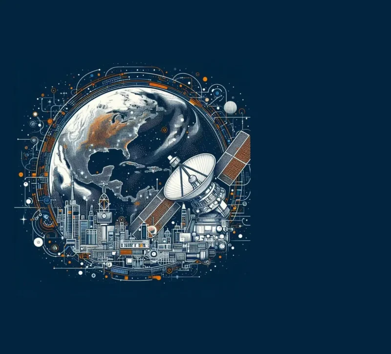
The Role of Technology in Earth Observation
In the world of Earth observation, technology plays a key role in unlocking the secrets of our planet. Thanks to advances in geoinformation and GIS, we can now observe the Earth with a precision that was previously unimaginable. Here are some crucial technologies transforming the field:
- Satellites: These eyes in space provide us with unprecedented visibility over vast and inaccessible areas. They are essential for monitoring climate change, land use, and even urban development.
- Drones: Closer to the ground, drones supplement the data we receive from satellites. They are perfect for detailed observations of specific locations, such as farmland or nature reserves.
- GIS (Geographic Information Systems): GIS is at the heart of Earth observation. It enables us to integrate and analyze data from various sources, allowing us to understand and solve complex issues related to our environment.
By combining these technologies, we can:
- Better understand climate change by monitoring changes in ice caps, forests, and oceans.
- Predict and manage natural disasters, such as floods and wildfires, by identifying risks early on.
- Develop sustainable agricultural practices by closely monitoring soil health and crop growth.
The impact of these technological advancements is enormous. Not only are we improving our knowledge of the Earth, but we’re also finding new ways to manage and protect our natural resources. At Geo-ICT, we embrace these developments and integrate them into our courses, so you’ll not only learn about the theory behind Earth observation but also how to apply these powerful tools in practice.
Real-World Examples of Earth Observation
Earth observation is more than just a technical discipline; it is an essential tool that solves real-world problems. Here are some practical examples that illustrate the power of geoinformation and GIS:
- Environmental Monitoring: By using satellite imagery, researchers can track changes in the environment, such as deforestation in the Amazon region. This provides crucial data for policymakers to take action against environmental degradation.
- Urban Planning: GIS technology helps urban planners create smart and sustainable urban development plans. By analyzing geodata, they can better understand where new infrastructure is needed or how traffic flows can be optimized.
- Agriculture: Farmers use Earth observation technologies to monitor crop health and determine the best time to sow or harvest. This increases yields and reduces waste.
These examples demonstrate how diverse the applications of Earth observation are. They also highlight the importance of a solid foundation in geoinformation for anyone working in these fields. At Geo-ICT, we ensure that our courses not only provide you with theoretical knowledge but also prepare you to apply these techniques in the real world. Whether you’re interested in environmental science, urban planning, or agriculture, our Earth observation training gives you the tools to make a difference.
This approach, which bridges theory and practice, makes our courses particularly valuable for professionals and enthusiasts of geoinformation. We encourage you to delve into the world of Earth observation and discover how you can turn your passion into actions that benefit the world.
Discover the World with Earth Observation
Earth observation offers a unique window into our world, an opportunity to map the complexity and beauty of the Earth like never before. With geoinformation and GIS as your tools, the world is literally at your feet. Whether you’re passionate about protecting natural habitats, interested in optimizing urban development, or simply fascinated by the possibilities of geodata, Earth Observation has something to offer everyone.
- Discover how environmental changes affect ecosystems around the world.
- Analyze urban expansion and its impact on social and economic structures.
- Use GIS to develop efficient solutions for agriculture and resource management.
At Geo-ICT, we are committed to providing education that is not only informative but also practical and inspiring. Our courses in Earth observation are designed to equip you with the knowledge and skills you need to drive real change. By understanding and applying the power of geoinformation, you can contribute to sustainable development and the protection of our planet.
We encourage you to broaden your horizons and explore the countless possibilities that Earth observation offers. With the right knowledge and tools, you can make a difference in the world. Let Geo-ICT be your guide on this fascinating journey through the world of geoinformation. Discover new perspectives, challenge yourself, and contribute to a more sustainable future.
This journey begins here, with the discovery of the possibilities that Earth observation offers. Step into the world of geoinformation and see for yourself how you can change the world, one dataset at a time.