Drone Survey Pilot

Defensie

Participants will learn how to use drones for surveying. Flying drones is straightforward, but collecting accurate data requires knowledge and preparation. This course prepares participants for the Online Drone Pilot A1/A2 and A3 exams.

Course duration: 3 days
3.8
13

Drone Survey Pilot

Asian construction worker piloting drone at building site. video surveillance or industrial inspection.

Drone Survey is at the forefront of technological advancements in collecting geospatial data and conducting land surveys. This method uses unmanned aerial vehicles (UAVs) to collect data essential for a wide range of applications, from urban planning to environmental management.

In a world where speed and accuracy are crucial, drone surveying offers unmatched efficiency by significantly accelerating surveying work while simultaneously reducing costs. At Geo-ICT, we understand the power of this technology and how it can be used to obtain accurate data that would otherwise be difficult, time-consuming, or even impossible to collect. Our Drone Survey Course is designed not only to introduce you to the fundamentals of drone flight and photogrammetry software, but also to develop your skills in collecting and analyzing geodata in a way that will shape the future of geoinformation.

The Essence of Drone Survey

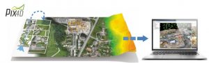
At the heart of drone surveying lies a revolutionary approach to how we collect geodata and map the world around us. This technology not only transforms the world of geoinformation by offering new perspectives and possibilities, but also changes the way professionals approach and conduct surveying. By taking to the skies with drones, we unlock the potential to reach areas previously considered inaccessible or too risky. It is this flexibility and accessibility that makes drone surveying so appealing for a wide range of applications. From mapping vast agricultural lands to accurately inspecting infrastructure, the possibilities are endless.

At Geo-ICT, we emphasize the importance of understanding these essential principles and applying them effectively to obtain accurate and reliable data. Our course offers not only an in-depth look at the operational aspects of drone flights, but also at how this technology can be used to solve complex geographic challenges.

Benefits of Drone Surveying

The rise of drone surveying has opened up a world of benefits, far surpassing traditional methods of land surveying and data collection. The most striking advantage is the unparalleled efficiency with which data is collected. Drones can fly over large areas in a short time and collect detailed geodata. As a result, projects that previously took weeks can now be completed within a few days or even hours. This speed goes hand in hand with impressive accuracy, as modern drones are equipped with advanced sensors and cameras that produce sharp, detailed images.

Another significant advantage is the accessibility of hard-to-reach locations. Drones can safely navigate areas that are dangerous or inaccessible to humans—such as steep terrain, densely vegetated areas, and urban environments. This opens the door to detailed studies and analyses across a variety of fields without compromising safety.

Moreover, the versatility of drones makes them suitable for a wide range of applications, from Earth observation and 3D scanning to the management of geospatial data. Integrating drones into daily workflows enables professionals to innovate and improve their methods, leading to better decision-making and optimized results.

What You Will Learn in the Drone Survey Pilot Course

Fundamental Principles of Drone Technology

Diving into the world of drone technology means understanding the basics that make these innovations so powerful and versatile. At Geo-ICT, we guide you through the fundamental principles essential for anyone who wants to work with drones.

  • Types of Drones: There are various types of drones, each with unique capabilities and applications. From small quadcopters to larger fixed-wing drones, the choice depends on your project needs.
    • Quadcopters are ideal for detailed geodata collection and aerial photography.
    • Fixed-wing drones offer longer flight times and are perfect for mapping large areas.
  • Flight Controllers and Navigation: Modern drones are equipped with advanced flight controllers that use GPS and other sensors to ensure precise navigation and stability during flight.
    • GPS provides precise positioning, which is essential for surveying and Earth observation.
    • Sensors such as gyroscopes and accelerometers help maintain the drone’s balance and proper orientation.
  • Sensors and Cameras: The power of drone surveying lies in the quality of the collected data. And this depends heavily on the sensors and cameras on board.
    • High-resolution cameras for sharp, detailed images.
    • Multispectral sensors for environmental studies and agricultural research.
  • Data Analysis Software: After collecting data, the next step is to analyze it using specific software packages.
    • Photogrammetry software enables the generation of 3D models from photos.
    • GIS software is used to manage and analyze geographic information. This enables informed decisions to be made based on the collected data.

Understanding these components is crucial to unlocking the full potential of drone technology and integrating it into your work. Taking this course will ensure that you become confident and proficient in applying this technology in practice.

Skills in Data Collection and Processing

The art of drone surveying goes beyond simply piloting a drone. It also encompasses the critical skills in data collection and processing required to extract valuable geospatial information.

Collecting data with drones is a process that requires care and precision. It begins with:

  • Planning the Drone Flight: Before taking to the skies, you must have a clear plan.
    • Determining the flight path and establishing specific waypoints.
    • Choosing the right time of day for optimal lighting conditions.
  • Executing the Flight: Once the drone is in the air, it is essential to:
    • Monitor the flight closely and make adjustments as the situation requires.
    • Ensure that all necessary areas are covered and that the data is consistent.
  • Data Review: After the flight, it is time to assess the collected data.
    • Verify the completeness and quality of the collected images and data.
    • Ensure the data is properly organized for further analysis.

The next step, data processing, is where the magic really happens. Using specialized software, you transform raw data into usable geoinformation:

  • Photogrammetry software: This allows you to create detailed 3D models and maps from the collected imagery.
  • GIS software: Essential for analyzing and managing geographic data. This enables you to draw insightful conclusions and make informed decisions.

These skills are not merely technical in nature. They also require a creative approach and problem-solving ability. At Geo-ICT, we ensure that you develop a deep understanding of both the theory and practice of these processes. This enables you to fully harness the power of drone technology and deliver high-quality geo-data.

Why Choose Our Drone Survey Pilot Course?

When choosing a drone survey course, you want to be sure you’re investing in quality education. Here are a few reasons why our Drone Survey Course is the perfect choice for anyone serious about developing their skills in this exciting and rapidly growing field:

  • Expert Instructors: Our course is led by experienced professionals who are active in the field. They bring a wealth of practical experience and share insights you won’t find in books.
    • In-depth knowledge of drone technology and geodata collection.
    • Personalized attention and guidance to optimize your learning experience.
  • Practical Curriculum: We strongly believe in learning by doing. Our course includes extensive hands-on sessions in which you will:
    • Learn to fly different types of drones.
    • Work with the latest photogrammetry and GIS software.
  • Access to State-of-the-Art Equipment: As a student, you’ll have access to the latest drones and sensors on the market. This allows you to learn with the tools you’ll use in the real world.
    • Experience the latest technologies in drone surveying.
    • Develop skills that are directly applicable to your work or projects.

Choosing the Drone Survey Course at Geo-ICT means investing in your future. It is a course that prepares you for the reality of working with drone technology in a variety of applications, from land surveying to Earth observation.

Read more

Enroll

€1695,- (VAT included)
  • Course duration: 3 days
Register for this course

Dagindeling

Day 1: Overview and mock exam practice

An Introduction to Surveying. How is surveying conducted in the Netherlands, and in what situations is the use of drones beneficial? If you want to collect geodata in the field as a drone pilot, you need to be familiar with the following topics:

  • Aviation safety and regulations
  • Airspace restrictions
  • Human performance
  • Operational procedures
  • General knowledge of unmanned aircraft
  • Privacy and data protection
  • Insurance
  • Meteorology
  • Flight performance

These topics are all covered, and you will be able to take the following two online exams at a certified training provider that Geo-ICT partners with:

  • Exam for the EU Drone License A1/A3; this exam consists of 40 questions
  • Exam for the EU Drone License A2; this exam consists of 30 questions

This provides participants with the proper context and mindset. What is involved in using drones to collect data, and which drones and software are suitable for producing a reliable end product? During the course, we also provide instructions on how to improve and assess the accuracy of the collected data.

You are now ready for Day 2, when you will actually fly a drone.

Day 2: Flying and gathering information

Geo-ICT Training Center, Nederland - Leergang Drone SurveyIn the afternoon, the group will head to the Bussloo recreational area for a survey; the technical term for this operation is "drone mapping".

On the second day, we’ll delve deeper into drone technology and offer tips on what to look for if you’re considering investing in a drone system. Under the instructor’s guidance, all participants will carry out a practical drone operation.

In the morning, we will thoroughly cover the preparations for a professional drone operation and explain what is required to become a certified drone pilot.

Day 3: Pix4D

On the third day, we process the data collected on day 2 using the Pix4D Mapper software program. This data processing yields various end products, such as digital terrain models (DTM/DSM), orthophotos (.tiff), and data for generating 3D models (digital twins) in the form of a point cloud. (.las/laz) The course provides insight into how these data concepts can be applied in practice and offers a simple explanation of how to use Pix4D Mapper.

Using the PIX4D Mapper software, participants will process the survey data acquired on Day 2 into a final product.

Course duration: 3 dagen
Sign me up

Leerdoelen

  • Knowledge of the basic principles of drone technology and the different types of drones used in surveying:
    • A learning objective could be to familiarize participants with the various components of drones, such as the flight controller, sensors, cameras, and batteries. In addition, they should understand which type of drone is best suited for specific surveying tasks.
  • Skill in planning and executing drone flights for data collection:
    • It is important that participants learn how to create a flight plan, taking into account factors such as weather, the environment, and the desired accuracy of the data. They should also learn how to safely operate a drone and monitor the collected data during the flight.
  • Understanding of data processing methods and software tools for processing drone data:
    • A key learning objective is to familiarize participants with software tools used to process and analyze drone data. This may include the use of photogrammetry software to create elevation models and orthophotos, as well as the use of GIS software to analyze the data and generate reports.
  • Application of drone data in surveying projects:
    • The ultimate learning objective could be to enable participants to effectively apply drone data in surveying projects. This includes understanding the accuracy and reliability of the collected data, integrating drone data with other surveying methods, and being able to interpret the results to obtain useful information for projects in the fields of construction, agriculture, urban planning, environmental management, and infrastructure development.
  • Possess all the knowledge required to take the online A1, A2, and A3 exams at a certified training provider that partners with Geo-ICT.

Trainers

Eva Smit

5.0
6 beoordelingen
9 studenten gingen je voor
ED

Externe Docent

Verschillende cursussen
4.4
265 beoordelingen

Anoniem

2 weeks geleden

Edwin Keizer

2 weeks geleden

Anoniem

2 years geleden

Anoniem

2 years geleden
Bekijk alle reviews

Want to know more?

Do you have questions about the course content? Or are you unsure whether the course aligns with your learning goals or preferences? Would you prefer an in-house or private course? We’d be happy to help.

Frequently Asked Questions About Drone Survey Basic

This course provides a comprehensive introduction to the use of drones for surveying purposes, including practical applications and relevant regulations. You will also be prepared for the online A1, A2, and A3 drone pilot exams.

The course is ideal for aspiring geospatial specialists, experienced professionals, those seeking career transitions, and educational institutions looking to gain practical knowledge of surveying with drones.

You’ll learn about drone flights, collecting accurate data, the applications of drone surveying in land surveying, and the relevant regulations. And you can become a certified drone pilot.

The course lasts 3 days and combines theory with practical training, giving you hands-on experience with drone surveying techniques and exam preparation for the pilot’s license.

The course includes training in Pix4D photogrammetry software and GIS software, which are essential for processing geospatial data collected via drones.

We do indeed offer two courses:

  • Drone Survey Pilot: In this course, you’ll become a drone pilot and learn how to perform simple surveying data collection yourself and process it in Pix4D. You’ll also fly a drone in the field and conduct a survey.
  • Drone Data Processing: In this course, you’ll learn about the various types of data that can be collected and the workflow involved. You’ll become familiar with multiple software packages featuring AI capabilities. There is no flying involved during this course.

On the third day of the Drone Data Processing course, we will work extensively with Pix4D software. This day is virtually the same as the third day of the Drone Survey Pilot course. This means that if you have already completed the Drone Survey Pilot course, you can skip this day. In that case, you will also receive a one-third discount on the price.

You can certainly program drones, but you won’t learn how to do that in this course. In that case, you can choose the course: Programming Drones with Python.

Yes, the course covers both theoretical knowledge and practical tips and insights, with a focus on the use of drones in surveying.

The first day includes an introduction to surveying, the use of drones for data collection, and an overview of relevant drone regulations in the Netherlands.

Yes, after the course, you’ll have two more weeks to ask the instructor questions via email.