
This course is intended for employees who wish to apply deep learning in QGIS for defense purposes. A solid foundation in QGIS is required.
Defensie
This course is intended for employees who wish to apply deep learning in QGIS for defense purposes. A solid foundation in QGIS is required.
Would you like to learn how to apply Deep Learning in QGIS for terrain reconnaissance and risk assessment?
During this hands-on training, you will use powerful GeoAI laptops and learn how to deploy Deep Learning models for geospatial analysis.
Important information:
Geo-ICT Training Center Netherlands is a member of the
AI Coalition Netherlands and supports the QGIS Community. With this course, we aim to promote the application of Deep Learning in QGIS in the Netherlands.![]()
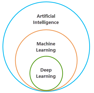
Deep Learning is an advanced form of machine learning in which neural networks can recognize complex structures in
geodata. This offers unprecedented possibilities for spatial analyses, such as image classification,
object detection, and identifying trends in large geospatial datasets.
In this course, you will learn how to apply Deep Learning within QGIS for military purposes in the defense sector. From the basic principles of neural networks to training and implementing models for military/geospatial applications. Whether you are a beginner or an experienced GIS professional, this course offers you valuable knowledge and practical skills.
Are you not yet familiar with QGIS? Then we recommend taking the QGIS basics course first.
Diving deep into the world of Deep Learning, we arrive at the basics: a form of machine learning. This technique uses multi-layered neural networks. This allows complex patterns in large amounts of data to be recognized and interpreted. This technology is essential for advancements in geoinformation and analysis. It mimics the functioning of the human brain. This allows us to perform advanced calculations with an efficiency that was previously unimaginable.
In Deep Learning, information is processed through various layers of neural networks. Each layer identifies specific characteristics of the data and passes it on. This process enables the performance of extensive geospatial data analyses, such as recognizing objects in satellite imagery or classifying landscape types. Thanks to this technology, QGIS can generate in-depth geospatial insights. This allows users to solve complex problems with a precision that pushes the boundaries of traditional geo-analysis methods.
In Geo-ICT’s Deep Learning in QGIS for Defense course, you’ll be guided through the fundamentals of this technique—from understanding the structure of neural networks to actually applying these networks for geospatial analysis. The course provides a solid foundation for anyone who wants to leverage the capabilities of Deep Learning in their projects. Moreover, this knowledge enables you to perform advanced analyses. In this way, you transform the way we think about and work with geoinformation.
By combining the power of Deep Learning with the advanced capabilities of QGIS, Geo-ICT opens the door to a new world of geospatial analysis for defense. The skills you gain in this course will better equip you to understand how geoinformation can help analyze terrain structures and identify tactical military advantages.
In an era where data drives decision-making and innovation, geoinformation plays a crucial role across a wide range of sectors. From urban planning and environmental management to logistics and emergency response—such as those focused on by the defense sector—the insights gained from geospatial analysis are indispensable. Here are a few reasons why geoinformation is so important:
The integration of Deep Learning technologies into geoinformatics opens up new possibilities for processing and interpreting geospatial data. With Deep Learning, we can identify complex patterns and correlations in data that previously went unnoticed. This increases the accuracy of geospatial analyses. It also enables the development of predictive models that can anticipate future trends and events.
At Geo-ICT, we recognize the growing importance of geoinformation, including within the defense sector. That is why we are committed to offering training courses that equip (military) analysts with the knowledge and skills to use this powerful tool. Our Deep Learning in QGIS for Defense course is specifically designed to bridge the gap between traditional geospatial analysis and the latest developments in machine learning and artificial intelligence. By participating in our course, you will not only gain insight into the fundamentals of geoinformation, but you will also learn how to apply advanced Deep Learning techniques to effectively map terrain structures and risks.
Deep Learning is a fascinating world where the fundamentals of artificial intelligence and machine learning converge to recognize and interpret complex patterns in data. At the heart of Deep Learning lie neural networks. These are structures inspired by the human brain that learn from large amounts of data. These neural networks are built from layers of nodes, or “neurons,” each of which processes and passes on small pieces of information.
The power of Deep Learning lies in these networks’ ability to identify deeper and more complex patterns in the data with each layer. This makes it possible to:
In Geo-ICT’s Deep Learning in QGIS for Defense course, you’ll dive deep into the world of neural networks. You’ll learn how to apply them within the field of geoinformation. You’ll discover how Deep Learning can be used for advanced geospatial analyses, such as:
Object and target recognition from satellite imagery: Automatic detection and classification of military vehicles, ships, aircraft, or infrastructure (e.g., bunkers, runways). Deep learning models such as convolutional neural networks (CNNs) are used to analyze large amounts of remote sensing data and identify potential targets.
Movement and pattern analysis: Using spatiotemporal deep learning models, GIS can detect suspicious movements or troop movements in time series of drone or satellite imagery. This helps predict enemy strategies and detect logistical patterns (e.g., supply routes).
Automatic terrain classification and navigation support: Deep learning can be used to classify the landscape (e.g., forests, rivers, urban areas, desert) with high accuracy. This supports military operations in route planning, camouflage analysis, and determining tactical advantage in combat zones.
This knowledge not only enables you to gain in-depth insights from geodata but also offers the opportunity to develop innovative solutions for challenges in diverse fields such as urban planning, environmental sciences, and crisis management.
Effectively applying Deep Learning in QGIS offers a wealth of possibilities for geospatial analysis and solving complex problems with geoinformation. The application of Deep Learning within QGIS for defense involves various steps and possibilities, such as:
Through the integration of Deep Learning with QGIS, Geo-ICT offers a course that provides not only theoretical knowledge but also practical skills to perform these advanced analyses independently. Participants learn how to:
These skills enable you to harness the full potential of geoinformation by applying advanced technologies such as Deep Learning to solve real-world problems.
The application of Deep Learning within QGIS highlights two crucial geospatial analysis methods: image classification and object detection. These techniques are invaluable for interpreting geospatial datasets. They offer the ability to analyze and understand large amounts of geodata.
Image classification and object detection use advanced Deep Learning models to:
These techniques are supported by a series of steps within QGIS, including:
In this course, we discuss practical military applications.
By participating in our Deep Learning in QGIS for Defense course, you will learn how to unlock the full potential of geoinformation by applying Deep Learning.
This will enable you to perform complex analyses and make accurate, data-driven decisions.
When choosing a course focused on the application of Deep Learning within QGIS, several factors set Geo-ICT apart as the ideal learning environment. Our course is carefully designed not only to provide theoretical knowledge of Deep Learning and geospatial analysis, but also to develop the practical application and technical skills required for professionals in the geoinformation sector. Here are a few reasons why our course is the right choice for you:
By choosing our Deep Learning in QGIS course at Geo-ICT, you’re not only investing in your professional development but also in the future of geospatial analysis. Sign up today to take your skills to the next level and contribute to the future of geospatial information.
The first day of the course focuses on the fundamentals of artificial intelligence (AI), machine learning, and deep learning. Students will gain insight into how neural networks work, why they are suitable for geospatial analysis, and what applications are possible within QGIS. Next, the course provides a step-by-step explanation of how to set up, install, and configure the QGIS environment for deep learning applications. During this session, students are introduced to key tools and example applications. The day concludes with practical exercises in which various deep learning models are applied within QGIS.
On the second day, students deepen their knowledge of deep learning in QGIS and learn to apply advanced techniques. The morning begins with a hands-on session on training custom models for tasks such as object detection and segmentation. This session covers architectural choices, hyperparameter tuning, and the labeling and annotation of data to create a training dataset.
In the afternoon, more complex topics are covered, including fine-tuning pre-trained models, transfer learning, and the implementation of deep learning in real-world military scenarios. Students will have the opportunity to apply these techniques.
The course concludes with an overview of best practices, common challenges, and future developments in deep learning for geospatial analysis.

Do you have questions about the course content? Or are you unsure whether the course aligns with your learning goals or preferences? Would you prefer an in-house or private course? We’d be happy to help.
The course is designed to teach participants how to apply deep learning within QGIS for advanced geospatial analyses, such as image classification and object detection.
A solid foundation in QGIS is required to participate effectively in this course. You can acquire this foundation in the QGIS Basics and QGIS Advanced courses.
The course lasts two days and combines theoretical knowledge with hands-on exercises to provide participants with a solid foundation and advanced knowledge in applying deep learning within QGIS.
Topics include an introduction to neural networks, deep learning models, and advanced techniques for data labeling and collection.
The course covers applications such as image classification, object detection, and change detection, which are useful in areas such as urban planning, environmental management, and disaster response (defense).