Getting Started as a Trainee

We are looking for college and university graduates throughout the Netherlands with an interest in GIS and geoinformation who can start immediately!
Geo ICT Trainee with a Company Car

More than 150 trainees have gone before you!

At Geo-ICT Training Center Nederland, you can get started even without a specific Geo-ICT background. We believe that all your previous experiences contribute to your success in the innovative geosector. Curious about our Geo-ICT traineeship? Read on!

Specializations in our Geo-ICT Trainee Program

  • Geodata Acquisition: Conducting and processing archaeological, surveying, hydrographic, pedological, and environmental surveys.
  • Geodata Processing: Digitally processing and maintaining BAG maps, BGT maps, green space maps, road maps, sewer maps, cadastral maps, risk maps, archaeological maps, spatial planning maps, fiber-optic network maps, elevation maps, hydrographic maps, land-use planning maps, risk maps, infrastructure maps, and building information maps.
  • Geodata Science: Working with many types of data combined with geographic maps. For example, by using GIS to perform complex spatial analyses and visualize the results.
  • Geo-ICT Software Developer: The Geo-ICT Software Developer writes, implements, tests, improves, and maintains GIS applications.
  • Geodata Publishing: Creating GIS analyses and publishing them on geodata WebGIS portals.

How does it work?

  • Online interview
  • Send Resume
  • Take courses
  • Placement with one of our many clients

Text

FAQs: Getting Started as a Trainee

Yes, absolutely. The most important thing is that you’re passionate about geographic maps. And that you want to help provide geographic information for the construction of thousands of homes, the energy transition, adapting to climate change, and water management.

Various graduates from vocational (MBO-4), higher professional (HBO), and university (WO) programs have already joined us. They come from fields of study such as: Geography, Earth Sciences, Archaeology, Business Administration, Bioinformatics, Biology, Soil Science, Forestry and Nature Management, Chemistry, Cultural Heritage, Data Science, Defense, Animal Management, Ecology, Environment, Geodesy, Geomedia, History, Computer Science, International Business, Coastal and Marine Sciences, Agriculture, Surveying, Environmental Management, Environmental Science, Music Technology, Physics, Plant Sciences, Law, Spatial Development, Tourism, Water Management, Wildlife Management, Mathematics, and Maritime Studies.

We’ll help you advance your education. With us, you can also pursue part-time studies toward an ASc, BSc, or MSc degree.

  • First, email your resume and cover letter to anton.schutte@geo-ict.nl.
  • This is followed by an online interview. We usually use Google Meet, but MS Teams is also an option
  • We’ll start working together right away to make your resume appealing to the geosector. 
  • You may take a free course with us, such as QGIS Basics, so we can get to know each other.
  • Finally, you’ll be hired, and we’ll work together to build your resume.
  • You’ll be employed by us for a year, and we’ll continue to build your resume
  • Interviews with one or more of our clients will follow fairly quickly.
  • After a year, if you wish, the client can hire you directly.
  • There are three winners: the client, you the trainee, and us, the platform for new graduates
  • You’ll have the same experience as the trainees who came before you.


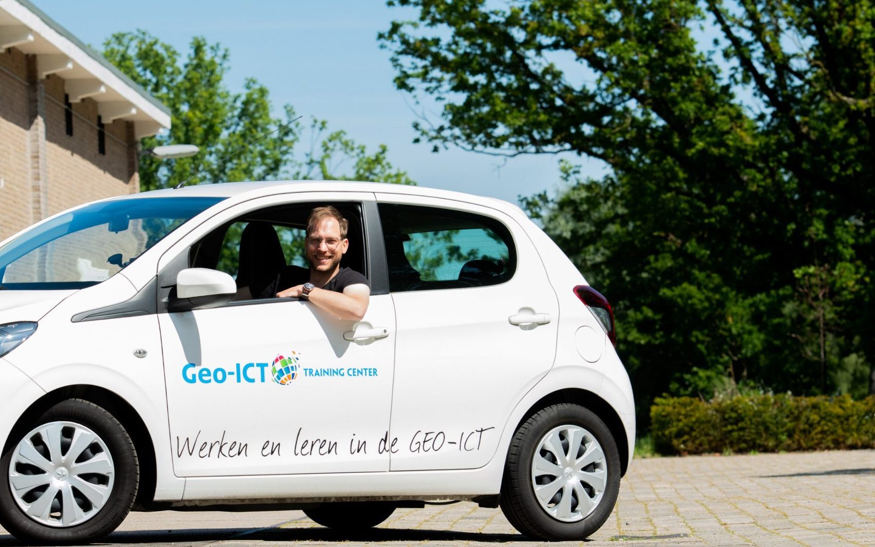
You will be employed by us, Geo-ICT Training Center, in the Netherlands. You will be covered by the ABU collective bargaining agreement for the temporary employment sector, and you will start contributing to your pension right away. Your travel expenses will be fully reimbursed. You can choose between reimbursement for public transportation or a company car. We drive white P108s with the Geo-ICT logo on them.

Geo-ICT Training Center, Nederland - traineeships

Yes, as a trainee, you are covered by the ABU collective bargaining agreement. ABU stands for the General Association of Temporary Employment Agencies. Under this collective bargaining agreement, you will accrue pension benefits through the Pension Fund for Personnel Services (STIPP).

As a trainee, you’ll be able to drive a company car. This could be a Peugeot 108, a Citroën C1, or a Toyota Aygo, for example. These are white cars bearing our logo.

Personal use

Using the car for personal use is very appealing. You’ll receive a fuel card, and everything else is included. The IRS considers this to be additional income on which you must pay income tax. They call this the “add-on.” They virtually add 24% of the car’s list price to your gross annual income. The list price of the cars mentioned is approximately €14,000, so (0.24 * 14,000 / 12) = €280 is added to your gross monthly income. At the trainee salary level, you pay approximately 30% income tax on that amount. So it costs you 30% of 280 = €84 net per month. This is deducted from your monthly salary each month.

Business use only

You can also use the car exclusively for business purposes. In that case, you must request a “Declaration of No Private Use” from the Tax Authority. We will then include this in our records. Additionally, you must keep a mileage log to demonstrate that you truly do not use the car for private purposes. In that case, you will not be subject to the additional tax liability.

  • The Dutch geospatial sector is undergoing significant growth and transformation thanks to advancements in ICT and artificial intelligence. What was once a closed, niche surveying market has now been completely transformed.
  • Traditional, insular surveying firms are being overtaken on all sides by companies actively engaged in ICT, the Internet of Things, geodata, machine learning, and geospatial deep learning.
  • Geo-ICT Training Center, Nederland - enorme groeimarktNevertheless, these companies remain a core foundation that plays a crucial role in the growth of the geospatial sector. With this vision in mind, any rational person can see an enormous growth market emerging in which many young people will have promising careers. The geospatial sector is set to flourish in the coming years.
  • In this context, the demand for specialized surveyors and Geo-ICT specialists is enormous. It is likely that this demand is at least comparable to that in other professions within the construction, engineering, and ICT sectors.
  • However, it is expected that demand in the geosector will be greater than in other sectors and that it will continue to rise in the coming years.
  • The geosector in the Netherlands consists of a large group of organizations engaged in the collection, processing, analysis, and application of geoinformation.
  • In 2009, 9,690 people were employed in this sector, and this number grew to 12,115 by 2020. Furthermore, in the future, water management by water boards will also become part of this sector. As the demand for geodata increases, so does the need for employees within this sector.
  • Furthermore, developments and trends indicate that Geodesy and Geo-ICT will play a significant role in the near future in various areas, such as climate adaptation, sustainability, optimization of transportation flows, and water management. As a result, the demand for personnel is expected to remain high and continue to grow over the next 10 years.
  • The number of people in the sector is expected to increase by 25% over the next 10 years. The sector aims to grow to 15,000 employees, which means that an estimated 3,000 job openings will arise over the next 10 years. On top of that, another 1,500 job openings will result from demographic trends, such as an aging population. Due to an aging population and a declining workforce, a total of 3,000 job openings are expected over the next 10 years. All in all, there will therefore be an estimated 6,000 job openings over the next 10 years.