The interplay between historical cartography and modern technology offers new insights into how we visualize and understand the past. This blog explores the innovative ways in which advanced tools such as GIS and digital reconstructions breathe new life into old maps, and how these developments help us better preserve and study heritage and history.
The convergence of historical cartography with modern technology is not only a fascinating field but also a crucial development in how we visualize and understand our history. This blog delves into the world of ancient maps, enriched by the latest technological innovations, from GIS (Geographic Information Systems) to digital reconstructions. Through this combined perspective, we can gain a deeper insight into both the past and the future possibilities of cartography. Discover how this unique integration of disciplines is transforming both education and research, and helping us to better understand and document our world.
Traditional cartographic techniques not only have a rich history but also contribute to our cultural identity. Over the centuries, methods such as hand-drawn maps and the use of simple surveying instruments have evolved. These techniques offer a unique insight into the past and highlight the artistic skills of cartographers from different eras.
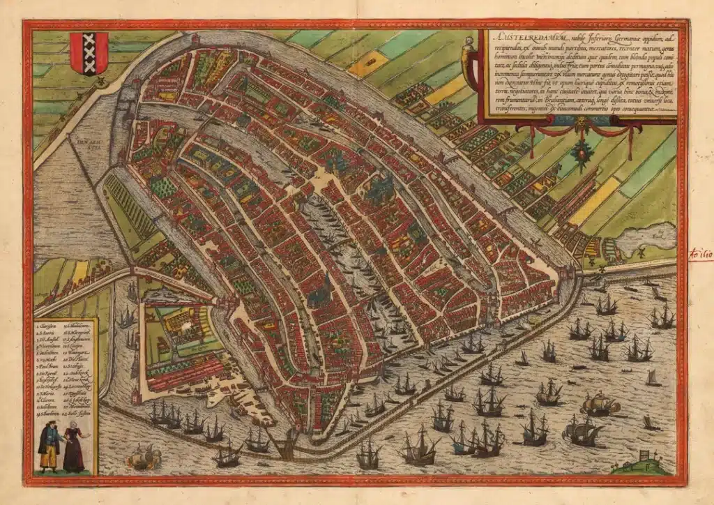
The cultural and historical value of these old maps is recognized, not only as works of art but also as essential documents for historical research. Maps such as those of the historic center of Paramaribo, for example, show the interaction between European and local architectural styles and materials, illustrating a gradual fusion of cultures..jpg)
In addition to their aesthetic and functional value, these maps play a crucial role in heritage preservation. Organizations such as Het Oversticht emphasize the importance of carefully integrating cultural-historical values into contemporary developments without compromising the integrity of monumental values.
The application of traditional techniques within modern cartography not only bridges the gap between old and new but also creates opportunities for education and the preservation of cultural heritage. For instance, within the heritage sector, attention is focused on the sustainable management of cultural-historical landscapes, in which both the tangible and intangible aspects are valued.
GIS has had a revolutionary impact on the accessibility of and interaction with historical maps. GIS technologies enable us not only to view historical maps, but also to analyze them and integrate them with modern geodata, facilitating a dynamic interaction between the past and the present.
Programs such as QGIS and ArcGIS Online offer extensive capabilities for adding custom data to historical maps, allowing users to create tailored visualizations that answer specific questions or test hypotheses about historical events and trends. This flexibility in manipulating and presenting data makes GIS an indispensable tool in both academic research and public history projects.
EduGIS further emphasizes how GIS can be used to make complex geoinformation accessible in a user-friendly way, and offers educational tools that help teach geographic concepts through interactive maps. This approach increases the accessibility of complex information, making it easier for a broader audience to understand and use geographic and historical data.
These advanced applications of GIS in working with historical maps open new doors for both researchers and the general public, making the rich history of landscapes and cities more accessible and understandable than ever before.
The power of modern software in digitizing historical data has opened up a new dimension in how we understand and appreciate our past. Through advanced digital reconstruction and analysis, it becomes possible not only to preserve historical data and maps but also to make them interactive, bringing this data back to life.
A striking example of how digital tools breathe new life into historical data is the use of GIS technologies. These systems enable researchers to georeference historical maps and integrate them with contemporary geographic data, yielding new insights into historical events and developments. Over the years, GIS has made it possible to analyze complex historical and archaeological sites, which is crucial for both educational purposes and preservation.
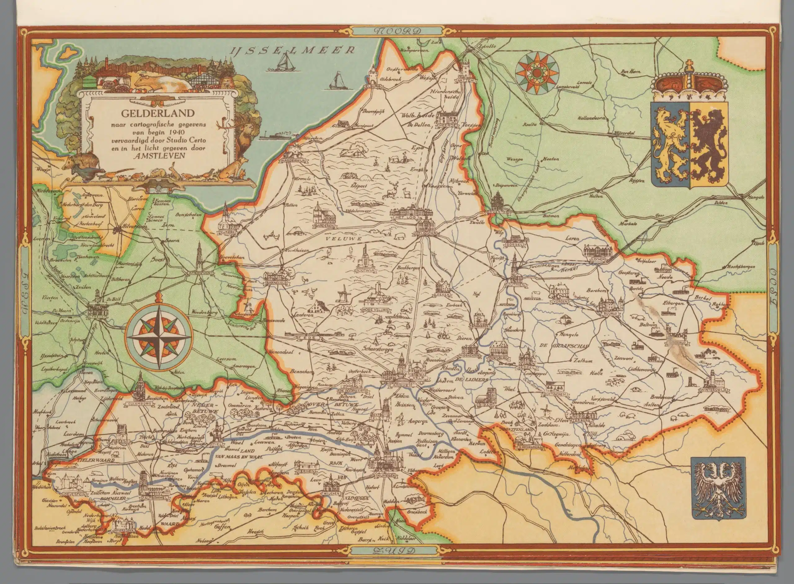
Another powerful example is the Topotijdreis project, in which 200 years of topographic maps of the Netherlands have been made interactive. Users can visualize changes in the landscape over a long period, contributing to a deeper understanding of urban development and landscape change. Such projects highlight how digital technologies make historical maps more accessible and useful to a broad audience.
These digital resources offer not only new ways to view historical data but also to interpret it. They provide powerful analytical tools that, for example, reveal patterns in urbanization, migration, or climate change across the centuries. This allows researchers and the public to ask questions and seek answers that may not have even been considered before.
In short, the digital reconstruction and analysis of historical data is transforming the way we study and present history. This creates a richer, more connected experience that enhances historical understanding for everyone.
The digitization of the Kraijenhoff Map, a groundbreaking project in Dutch cartography, perfectly illustrates how modern technologies can breathe new life into historical maps. This project focused on the accurate digitization of this historical map, which was originally completed in 1823, and marks an important milestone in the documentation of the Dutch geographical and political boundaries of that era.
The digitization enabled researchers to make the map available in high resolution for both education and research, and facilitated a deeper understanding of the historical landscape changes in the Netherlands. This project highlights the power of digital tools in preserving and studying cartographic heritage.
Interactive maps play a crucial role in both education and research by stimulating active learning and enriching the educational process. These technologies bring historical and geographical data to life, allowing users to gain not only visual but also interactive experiences that enhance their understanding of complex topics.
In education, interactive maps are used to help students visualize and understand complex geographical and historical relationships. By using these tools, students can make independent discoveries and draw connections between different data. This type of hands-on learning increases engagement and helps students better understand information, leading to deeper and more meaningful learning.
The use of such technologies in educational institutions not only supports traditional learning objectives but also opens the door to new forms of research and analysis. By using interactive maps, researchers can identify patterns and test hypotheses in ways that were previously impossible. This digital tool enables them to quickly process and visualize large amounts of information, which is essential in an era where data is becoming increasingly important across all academic disciplines.
The world of cartographic software is constantly evolving; new technologies continue to transform the field and offer unprecedented opportunities for both mapmakers and users of geographic information. Modern cartographic applications embrace a wide range of emerging technologies that enhance the precision, accessibility, and interactivity of geographic data:
These technological advancements not only enhance the functionality of cartographic tools but also make them more accessible to a broader audience. Educational institutions, research institutes, and government agencies all benefit from the improved capabilities to explore and present geographic information in ways that were previously impossible.
Essentially, these developments in cartographic software ensure that the application of geographic information is increasingly integrated into our daily decision-making processes, enabling us to make better-informed decisions.
The integration of modern technologies such as GIS, AI, and Big Data into cartography has revolutionized our ability to interpret and present geographic information. These technologies not only provide deeper insights through complex data analysis but also make maps more interactive and accessible than ever before. They enable us to create dynamic, up-to-date maps that are crucial for education, research, urban planning, and environmental management. The future of cartography promises even greater integration of digital innovations, continually pushing the boundaries of what is possible.