
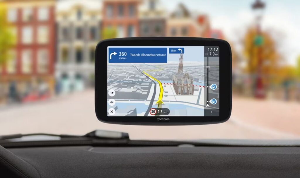
Although many hikers still prefer to use a paper map and perhaps a compass, or simply “follow the trail markers,” GPS and pre-planned routes have become indispensable. What began as a military project in the 1970s, exclusively for defense and maritime use, has been widely available to the general public since 2000. The intentionally reduced accuracy of the signal for civilian use was then lifted, paving the way for countless new applications. The rise of TomTom as a car navigation system marked a true revolution and made GPS technology definitively mainstream.
Over the years, the necessary electronics became increasingly smaller, more affordable, and more user-friendly. This made GPS attractive for recreational use as well. Today, the technology fits right in your pocket, is found in virtually every smartphone, and there are even small GPS tags to help locate pets or keys.
Hiking GPS devices have also undergone significant development over time. Even before the year 2000—when civilian access to the signal was still limited—Garmin launched a portable device in 1995 that was specifically designed for outdoor use. These early devices had no color screen or maps; the user had to navigate based on coordinates and an arrow pointing the way to the next waypoint.
Modern hiking GPS devices are a world apart. Detailed maps are displayed in color, and instead of individual waypoints, you can now follow complete tracks. For traditional map readers, this sometimes feels like “cheating,” but for many, convenience is key. Thanks to a hiking GPS, you don’t have to worry about getting lost.
Still, a word of caution is in order: GPS devices rely on signal and power. In remote areas, it’s therefore wise to bring a paper map as a backup. In the Netherlands, the chance of serious problems is small: the signal is stable, and the nearest road or buildings are never far away.
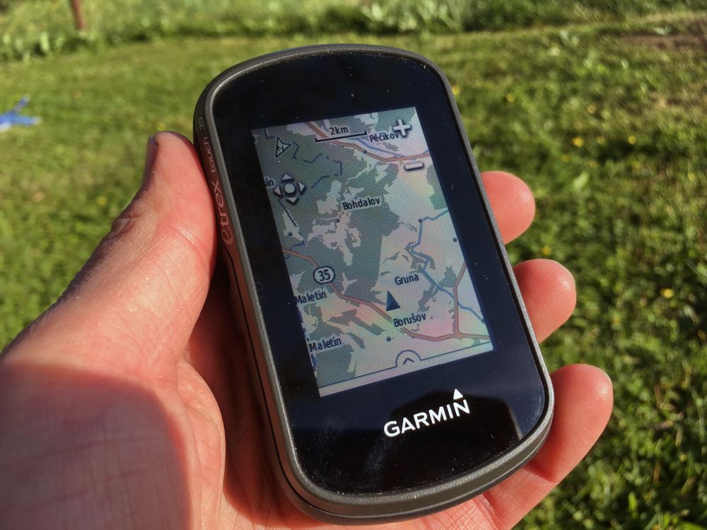
Before smartphones became ubiquitous, handheld GPS devices were the standard for hikers. These rugged devices are still being produced, despite the rise of smartphones. Their advantages are numerous: they’re built for rugged outdoor use, can withstand rain, bumps, and drops, and often run on replaceable AA or AAA batteries. That’s a major advantage over modern smartphones with built-in batteries that are difficult to charge on the go, unless you carry a heavy power bank—with the associated drawbacks of extra weight and cables.
Smartphones are, of course, very well-suited for navigation, provided you use the right apps. Standard apps like Google Maps, Waze, or Here are designed for cars and lack details that are of interest to hikers. Specific apps such as Komoot, Outdooractive, AllTrails, or Topo GPS offer much more functionality and hiking routes, often shared by other users.
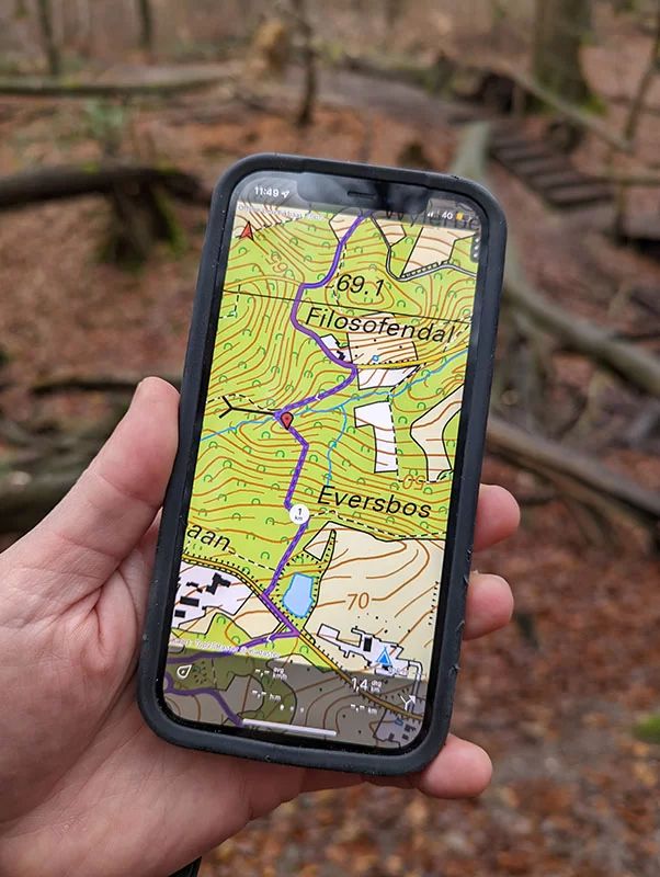
Topo GPS, for example, offers virtually all the features of a handheld device, but with the ease of use of a smartphone. These apps are often free, but you have to pay for the maps. These maps are usually based on OpenStreetMap, which is free in itself. So you’re not paying for the map, but for access to the maps within the app. Fortunately, this is usually a one-time purchase rather than a subscription.
Important tip: GPS works even without a cellular network. So you don’t need a signal to navigate. The GPS network is completely separate from the cellular network. You can even turn off your mobile data and continue navigating without any issues.
Smartwatches are rapidly gaining popularity, especially among athletes. Originally used to track performance while running and cycling, they now include navigation features. Modern models display maps and walking routes on the screen, alert you when you veer off course, and let you navigate without holding a smartphone—a quick glance at your wrist is all it takes.
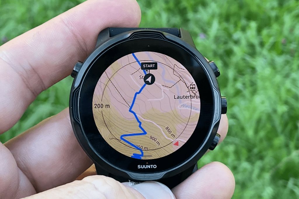
However, most smartwatches do work in conjunction with an app on your phone, especially for setting routes or syncing data. Once set up, they function largely independently.
Thanks to years of technological development, GPS navigation is more accessible and user-friendly than ever. Whether you choose a rugged handheld GPS, a smartphone with a specialized app, or an advanced smartwatch, there’s a suitable option for every hiker. Whereas map reading used to be a must, nowadays a quick glance at a screen is all it takes. Still, it remains valuable to know the basics of navigation—because no matter how smart your device is, you can only truly get lost if you yourself no longer know where you are.
Want to learn more about GPS in Geo-ICT? Then the basic GPS course or GPS in Construction might be just what you’re looking for!