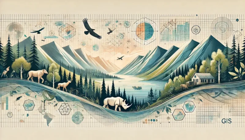
Geoinformation is a dynamic and rapidly growing field with countless career opportunities. Whether you’re just starting out or a seasoned professional, there are various paths you can take within this sector. In fact, 80% of all data contains a geographic component, so you may be working with geoinformation without even realizing it.
In this article, we explore the various career opportunities and the skills you need to succeed in the exciting world of working with geodata. By delving into geoinformation and related technologies, you can make a valuable contribution to projects ranging from urban planning to environmental research. In addition, at Geo-ICT, we offer courses that can help you further develop your knowledge and skills. Read on and discover the exciting career opportunities that geoinformation has in store for you!
A career in geoinformation offers a wide range of opportunities. Whether you enjoy technical challenges or are looking for creative solutions, there’s something for everyone. One of the most popular careers is that of a GIS specialist. As a GIS specialist, you work with geographic information systems to collect, analyze, and visualize geodata. You can work on projects ranging from urban planning to environmental management.
Another more hands-on profession where you spend a lot of time outdoors is that of a surveyor; here, you collect geo-data that CAD operators or GIS specialists then use.
There are also opportunities as a geodata analyst, where you focus on interpreting and analyzing geographic data to identify trends and patterns. These analyses are crucial for decision-making in both the public and private sectors. You play a key role in solving complex spatial issues.

As a CAD Draftsman, you are responsible for creating technical drawings based on survey data, design plans, or fieldwork. You use CAD software such as AutoCAD or MicroStation to create detailed floor plans, profile drawings, and construction drawings. These drawings are essential for the preparation and execution of construction, civil engineering, or infrastructure projects. Accuracy, an eye for detail, and an understanding of spatial structures are indispensable in this role.
There are thus many career opportunities within geoinformation, each with its own unique challenges and rewards. It is a field that is constantly evolving, which means there are always new opportunities and technologies to explore.

BGT and BAG administrators play a crucial role in keeping key basic registries up-to-date and accurate: the Large-Scale Topography Basic Registry (BGT) and the Addresses and Buildings Basic Registry (BAG). In these roles, you’ll work with geodata for the government, perform quality checks, and ensure proper integration with other datasets. You’ll serve as a vital link between data and policy in the public sector.
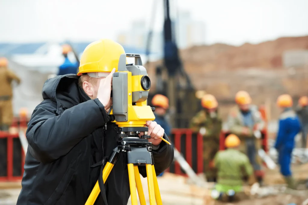
The role of surveyor is a classic yet indispensable profession within the geo-world. You conduct field measurements to record the location of objects, for example for infrastructure projects, cadastral boundaries, or underground pipelines. Using modern equipment such as GPS and total stations, you provide accurate measurement data, which is then used in maps, plans, and models.
So there are many career opportunities within geoinformation, each with its own unique challenges and rewards. It is a field that is constantly evolving, which means there are always new opportunities and technologies to explore.

A GIS specialist plays a crucial role in the management and analysis of geographic data. As a GIS specialist, you work with specialized software to collect, analyze, and visualize spatial data. Your tasks range from creating detailed maps to developing geospatial databases.
Technical expertise is essential in this role. You will work extensively with GIS software such as Esri and QGIS to transform complex data into actionable insights. Additionally, knowledge of programming languages like Python and JavaScript is a plus, as they help automate workflows and improve productivity.
Another important aspect of a GIS specialist’s work is data maintenance. You are responsible for ensuring the accuracy and quality of geographic data. This involves following strict guidelines for collecting, storing, and managing data.
GIS specialists are also involved in producing both paper and digital maps. These maps are used in a wide range of applications, from urban planning to environmental management.
In summary, a career as a GIS specialist offers a challenging and versatile work environment. With the right skills and a passion for geographic data, you can make a valuable contribution to various projects.
As a geo-application administrator, you are responsible for the management, configuration, and maintenance of geospatial software applications within an organization. You ensure that GIS systems such as ArcGIS or QGIS function optimally and assist users with technical questions. Additionally, you are involved in updates, integrations with other systems, and testing new functionalities. This role requires a combination of technical knowledge and communication skills.
In the world of geoinformation, mastering various technical skills is essential for success, although this does depend somewhat on the role you will be filling. For a surveyor, these skills are less strictly required but are still an asset for demonstrating technical insight—which is certainly important when collecting geodata, for example.
But as a GIS specialist, for example, you must be familiar with various tools and techniques for analyzing and visualizing geographic data. Here are some crucial technical skills you’ll need:
Mastering these technical skills enables you to work effectively with geospatial data and make a valuable contribution to various projects.
To succeed in the field of geoinformation, it is essential to pursue the right education and certifications. In the Netherlands, there are several opportunities to develop your skills in this area:
We at Geo-ICT.nl also offer various courses specifically designed to improve your skills in geoinformation.
Our programs are suitable for both beginners and advanced professionals and can help you further develop your career within this dynamic sector.
With these training programs and certifications, you can acquire the knowledge and skills needed to succeed in the field of geoinformation. By investing in your education, you increase your chances of a successful career in this growing field.
The geoinformatics sector is constantly evolving thanks to innovative technologies. By 2024, several trends will drastically change the way we use and analyze geographic data.
By embracing these technologies, you can benefit from the latest innovations and make your work more efficient and effective.
The future of GIS technology looks promising with various emerging trends. One of the most significant developments is the integration of the Internet of Things (IoT) with GIS. This combination enables the collection and analysis of real-time data, which is crucial for applications such as smart cities and environmental monitoring.
Another key trend is the use of artificial intelligence (AI) and machine learning. These technologies improve the accuracy and efficiency of geographic analyses by recognizing patterns and automating complex tasks.
In addition, the continued development of high-resolution satellite imagery will play a major role in improving spatial analyses and environmental management.
These developments will continue to transform the way we use and interpret geographic data, creating new opportunities for more accurate and efficient decision-making.
The future of career opportunities in the field of geoinformation is promising and diverse. The integration of new technologies such as IoT, AI, and machine learning will continue to transform the way geographic data is collected and analyzed. Real-time data analysis and high-resolution imagery offer unprecedented accuracy and insight, which is crucial for applications in urban planning, environmental management, and disaster response.
With the right skills and training, you can capitalize on these emerging trends and build a successful career in this dynamic field. By investing in your education and staying up-to-date with the latest technological developments, you can make a valuable contribution to projects that improve our world. Geoinformation offers not only career opportunities but also the chance to have a positive impact on our society.
Has reading this blog sparked your interest? We’d love to hear from you—whether for an introductory conversation or to apply directly! Check out our traineeship program or our current job openings.