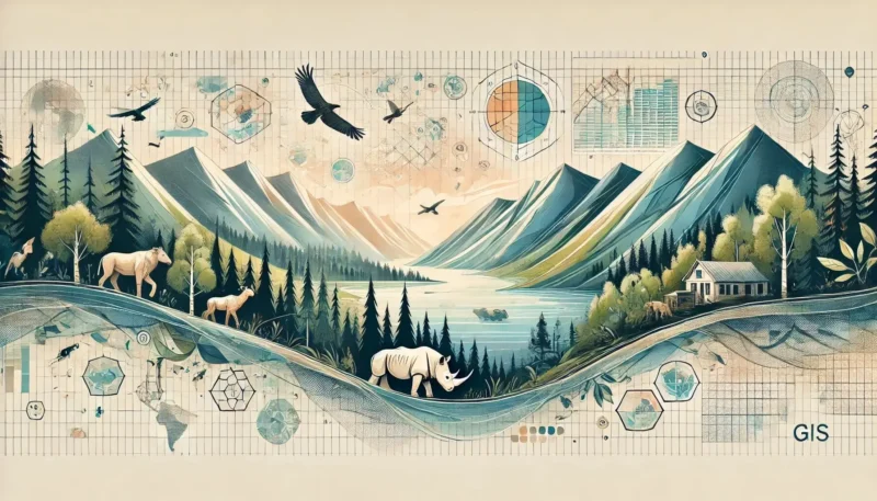
GIS technology plays a crucial role in the conservation of our natural environment. By combining geographic data with powerful analytical tools, GIS helps conservationists map vulnerable ecosystems and take targeted action. This technology makes it possible to effectively monitor biodiversity and optimize ecological management, which is essential for nature conservation in an era of accelerating climate change.
GIS, or Geographic Information System, is a powerful technology that allows you to collect, manage, and analyze geographic data. Imagine being able to create a detailed map that not only shows where forests and rivers are located, but also where endangered species live and which ecosystems are vulnerable. With GIS, you can not only map this data but also answer complex questions, such as: “Which areas have the highest biodiversity?” or “Where are the living conditions most favorable for a particular species?” Thanks to these insights, conservationists can deploy their resources effectively and protect nature in a targeted manner.
Now that you know GIS is important for nature conservation, it’s time to understand exactly what GIS is and how it works. GIS is a technology that collects and analyzes geographic data to gain insights into spatial relationships. But it goes beyond just creating maps. With GIS, you can combine multiple layers of data—such as the locations of waterways, forests, and the distribution of animal species—and use this data to perform in-depth analyses.
One example is using GIS to analyze the effects of climate change on coastal areas. GIS can combine data on sea-level rise, shoreline changes, and habitat shifts to determine which parts of the ecosystem are most vulnerable. This allows conservationists to take targeted measures to strengthen vulnerable areas and preserve biodiversity. In addition, GIS enables you to monitor and manage the impact of human activities, such as agriculture or urban development, on natural habitats.
It is this combination of spatial and ecological analyses that makes GIS so powerful. Instead of working with isolated data, GIS provides a holistic view that is crucial for effective conservation strategies. This allows us not only to protect what exists today but also to plan for a more sustainable future.
Monitoring biodiversity is crucial for nature conservation, and GIS plays an indispensable role in this. Biodiversity refers to the variety of life forms in a given area, and its preservation is essential for maintaining healthy ecosystems. With GIS, you can accurately map where different species are located, how their populations are developing, and what factors influence their survival.
Imagine you are responsible for protecting an endangered species. Using GIS, you can collect data on where this species occurs, what habitats it needs, and what threats exist. By combining this information, you can not only see where the species is currently located but also predict where its habitats may come under pressure in the future.
In addition, GIS helps identify so-called “biodiversity hotspots”—areas that are particularly rich in different species and therefore prioritized for protection. By monitoring these hotspots, conservationists can quickly respond to changes in the ecosystem and take targeted action to protect endangered species.
Ecological management revolves around maintaining and restoring ecosystems, and GIS is a powerful tool for this. With GIS, you can bring together various types of data to gain a detailed picture of the ecological processes taking place in an area. This enables conservationists to make informed decisions about where and how to focus their efforts.
For example, if a particular area is dealing with invasive species that threaten native flora and fauna, GIS can help pinpoint exactly where these threats are located and how they are spreading. This makes it possible to take targeted action and implement measures to prevent further damage.
In addition, GIS can help optimize restoration projects. By combining historical data with current measurements, managers can create plans that focus not only on preserving what currently exists but also on restoring what has been lost. The use of GIS ensures that every intervention is as effective and sustainable as possible.
GIS technology has already contributed to numerous successful biodiversity projects worldwide. By combining geographic data with ecological knowledge, conservationists have achieved some impressive results that have improved biodiversity in vulnerable areas. Here are a few examples of projects in which GIS played a crucial role:
These projects demonstrate how powerful GIS can be in supporting biodiversity management. Through accurate data analysis and the mapping of crucial ecological networks, we make nature stronger and more sustainable.
GIS continues to evolve and utilizes innovative techniques to take nature conservation to the next level. These technologies combine advanced data analysis with innovative applications, resulting in more targeted and efficient conservation strategies. Here are some of the most groundbreaking techniques applied with GIS:
These innovative techniques make GIS an indispensable tool in modern conservation. By bringing technology and conservation together, we can address the challenges of today and tomorrow more effectively.
GIS has proven to be an indispensable tool in nature conservation. By translating complex data into clear insights, it enables conservationists to make informed decisions. From accurately monitoring biodiversity to supporting ecological management and applying innovative techniques, GIS plays a crucial role in protecting and restoring our natural environment.
The technology not only enables us to identify threats early on, but also to develop effective restoration strategies. Innovations such as drones, predictive analytics, and AI make it possible to intervene more quickly and precisely, which is crucial in this era of accelerating climate change and biodiversity loss. By integrating GIS into conservation strategies, we create a future in which nature is more resilient and we can preserve its richness for future generations.