At Geo-ICT, we understand that the world of hydrography is broad and diverse, just like the needs of our students. That’s why we offer a wide range of courses covering every aspect of hydrography and geoinformation. From an Introduction to Hydrography for those new to the field, to Multi-Beam Surveying for professionals looking to deepen their skills in specific surveying techniques. We also offer a QGIS Marine Data course, perfect for those who want to specialize in using GIS software for marine data analysis. Each course is designed to build upon the others, allowing you to lay a solid foundation and expand your knowledge step by step. Whether you want to start your career in the geoinformation world or further specialize, at Geo-ICT you’ll find the course that suits you.
The Role of Hydrography in Modern Navigation and Coastal Management
Hydrography plays an indispensable role in the modern world, especially when it comes to navigation and coastal management. With increasing pressure on our coastal areas and the need for safe shipping routes, the value of accurate hydrographic data only grows. This is where geoinformation and GIS technologies play a crucial role.
- Safe Navigation: Hydrographic data enables the creation of detailed nautical charts that are essential for the safe navigation of ships. Without this data, ships would be at risk of grounding or other dangerous situations.
- Coastal management: Accurate hydrographic information helps monitor coastal erosion and plan coastal defense works. It also supports the management of natural resources and the protection of vulnerable ecosystems.
Hydrographic surveys and analyses, conducted using advanced GIS tools, form the basis for the effective management and use of our water-rich areas. They help identify potential underwater hazards, plan new infrastructure projects, and support scientific research into marine environments.
The importance of hydrography extends beyond mere technical aspects. It contributes to economic development by making shipping safer and more efficient, which is essential for global trade. Furthermore, it plays a key role in promoting the sustainable management and use of marine and freshwater environments.
By investing in hydrographic research and training, such as that offered by Geo-ICT, you are taking a step toward a future in which we better understand, protect, and utilize our waterways and coastlines. It is not only an investment in your personal growth but also in the future of our planet.
Technological Advances in Hydrographic Surveying
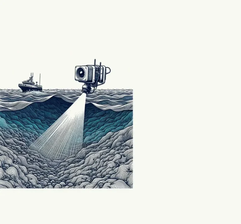
The world of hydrographic surveying has seen significant technological advancements in recent years, particularly through the integration of geoinformation and GIS technologies. These advancements have significantly improved the accuracy, efficiency, and capabilities of hydrographic surveying.
- Multibeam echo sounder systems: These systems provide detailed and accurate seabed profiles by utilizing multiple sound waves. They are crucial for mapping the seabed and identifying underwater objects and structures.
- Satellite positioning: Technologies such as GPS and GNSS allow hydrographers to determine their position with unprecedented accuracy, which is essential for precise mapping.
- Advanced data analysis software: Software such as QGIS and other specialized GIS programs enable hydrographers to analyze and visualize collected data, simplifying the interpretation of complex information.
These technological advancements have not only transformed the way we explore and understand the underwater world, but they have also opened the door to new applications and possibilities. For example, it is now possible to conduct environmental impact studies with a level of accuracy that was previously unimaginable, and we can improve coastal management and navigation systems to enhance both the safety and sustainability of maritime activities.
By capitalizing on these technological advancements, a course or program at Geo-ICT prepares you not only for the current state of the field but also for future developments. Investing in your knowledge of these technologies means investing in a future where you’ll be at the forefront of hydrographic surveying.
Career Opportunities in Hydrography
The world of hydrography offers a wide range of career opportunities, especially for those with a passion for geoinformation and GIS. Whether you’re interested in the environment, maritime navigation, or water resource management, hydrography has something to offer.
- Hydrographic Surveyor: A role in which you are directly involved in collecting and analyzing data on the physical characteristics of water bodies.
- Marine GIS Specialist: Focused on managing and interpreting marine data using advanced GIS software.
- Project Manager for Coastal and Marine Projects: Responsible for leading projects related to coastal management, erosion prevention, and habitat restoration.
Each of these roles requires a unique combination of skills, ranging from technical expertise in the use of survey equipment and GIS programs to a deep understanding of marine ecosystems. Furthermore, the demand for professionals in hydrography continues to grow, partly due to the increasing focus on climate change, sea-level rise, and the sustainable management of water resources.
A training program or course in hydrography at Geo-ICT can equip you with the knowledge and skills needed to succeed in this dynamic and essential sector. Investing in your education is not only an investment in your personal development but also in the future of our planet.
Thanks to technological advancements and the growing need for accurate data on our waters, there are plenty of opportunities for those aspiring to a career in hydrography. So whether you’re just starting out or looking for a career change, the world of hydrography welcomes you with open arms.