
In the Civil Engineering program, students gain an overview of civil engineering and learn in depth how to use AutoCAD, AutoCAD Civil 3D, and QGIS as a project planner and/or designer.
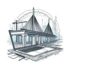
Construction and Civil Engineering
In the Civil Engineering program, students gain an overview of civil engineering and learn in depth how to use AutoCAD, AutoCAD Civil 3D, and QGIS as a project planner and/or designer.
 Civil engineering is a field that focuses not only on the development but also on the maintenance of our essential infrastructure. From bridges to roads, from levees to water treatment plants. Civil engineers are the unsung heroes who ensure that our society functions, is safe, and is ready for the future. It is a field that embraces innovation and constantly seeks sustainable solutions to the complex challenges facing our world.
At Geo-ICT, we understand the crucial role that geoinformation and geodata play in modern civil engineering. The use of advanced software such as AutoCAD, AutoCAD Civil 3D, and QGIS enables civil engineers to create accurate, efficient designs—designs that are not only economically feasible but also environmentally responsible. Our Civil Engineering Course is specifically designed to provide you not only with the theoretical knowledge you need, but also with practical skills in these essential tools.
This training highlights the importance of integrating 2D and 3D information into your projects. This enables you to visualize and plan complex civil engineering projects with unprecedented accuracy. The focus on object-oriented geoinformation aids in the efficient management of data. This is crucial when designing sustainable and resilient civil structures.
So, are you passionate about building a better future and solving major challenges? Then civil engineering might be the perfect field for you. And with the support and expertise of Geo-ICT, you’re well on your way to making an essential contribution to our world.
Check out our construction course as well. This course teaches you how civil engineering, construction engineering, and geoinformation technology work together to realize the construction projects of tomorrow!
In the world of civil engineering, geoinformation plays a crucial role. This information helps in designing, planning, and executing projects with a precision that was once unimaginable. Geoinformation, or geodata, is used to support a wide range of decisions in civil engineering, from surveying to urban planning.
The application of geoinformation in civil engineering extends beyond the points listed above. It is also used for:
By integrating geoinformation into civil engineering, projects can be executed not only more efficiently but also more sustainably. The ability to visualize and analyze complex data provides in-depth insights that are essential for the modern civil engineer. This underscores the importance of geoinformation in the field and why a thorough understanding of it is invaluable for anyone working or aspiring to work in this sector.
Geo-ICT plays a key role in this by offering courses that not only teach the technical skills needed to handle this data but also provide insight into how this information can best be applied within civil engineering projects.
The continuous evolution of technology has a profound influence on modern infrastructure. This opens up new possibilities that were previously unimaginable. In civil engineering, the application of technological innovations has not only transformed the way projects are planned and executed, but also how we think about the future of urban and rural spaces.
Here are some key points on how technology is shaping modern infrastructure:
However, the impact of technology extends beyond the construction sector alone. It contributes to a holistic approach to urban planning and management, with an emphasis on:
The role of geoinformation and geodata within this technological revolution is indispensable. It provides the data needed to understand the interaction between built environments and their geographic context. By integrating this data with technological tools such as GIS and BIM, civil engineers can not only shape the physical world around us but also anticipate the future needs of our society.
At the heart of modern civil engineering and urban planning lies a deep interconnection with geoinformation and Geographic Information Systems (GIS). These technologies enable the collection, analysis, and visualization of complex data about our physical world. This makes them indispensable for any project that shapes the infrastructure of our society.
The importance of a thorough understanding of geoinformation and GIS cannot be overstated, especially when it comes to:
Here are some concrete applications of geoinformation and GIS in civil engineering:
Geo-ICT Training Center recognizes the importance of these skills in today’s geo-information-driven world. By offering specialized courses in GIS and geoinformation, Geo-ICT aims to equip professionals with the knowledge and tools needed to excel in their field. These courses are designed to impart not only theoretical knowledge but also practical skills through hands-on experience with leading software such as QGIS and AutoCAD.
A crucial aspect of learning, especially in a technical and dynamic field such as civil engineering, is the application of theory in practice. At Geo-ICT Training Center, great value is placed on this practical application. It not only reinforces knowledge but also refines the skills needed in the real world.
The transition from theoretical concepts to practical applications encompasses various facets, including:
A few examples of how Geo-ICT translates this theory into practice include:
At Geo-ICT Training Center, the connection between theory and practice is central to the learning process. This ensures that students leave not only with a solid foundation of knowledge, but also with the competence and confidence to apply this knowledge in their professional lives. This makes our Civil Engineering Course not just a learning experience, but a springboard to a successful career in the world of civil engineering, enriched by the power of geoinformation and GIS.
Choosing our Civil Engineering Course means choosing a future in a field that is becoming increasingly important. Here are a few reasons why this course is the perfect choice for anyone interested in civil engineering and geoinformation:
Thanks to the Geo-ICT Training Center’s hands-on approach, theory is immediately applied to real-world projects. This ensures a learning experience that not only equips you with the necessary knowledge and skills but also prepares you for the real world. Offering both in-person and online course options provides flexibility and accessibility for everyone, regardless of location.
 On the first day, you’ll receive a general introduction to civil engineering. This will set the stage for this course. At the start of a civil engineering project, a great deal of map data is required. You will learn what types of map data are available and how to access them. Using QGIS, you will consult, download, and modify the basic registrations from the Land Registry, Large-Scale Topography, and Addresses and Buildings databases for use in a civil engineering project. On this first day, you will also get started with AutoCAD, with an emphasis on the practical aspects of drafting. The interface and settings will be reviewed, after which you’ll begin with exercises. You’ll draw various objects, such as lines, circles, arcs, rectangles, and triangles. Next, you’ll explore how objects can be modified: deleting, rotating, moving, scaling, and mirroring.
On this day, text and tables will be added to the drawings. The use of layers in drawings is important for keeping elements separate. Furthermore, extensive attention is given to object snaps and grips, blocks, and surface hatching. The relationship between model and paper space is also covered. Afterward, all components of AutoCAD Civil 3D are covered, based on 3D terrain models. This enables the student to recognize solutions for specific civil engineering problems and apply them in principle.
We’ll start with the application’s workspace. We’ll look at styles, template drawings, and reports. We’ll also cover surveying applications, working with points and terrain models, for example. We’ll also cover various profiles, such as cross-sections and longitudinal profiles. The following topics will be addressed: Volume calculations (grading), Alignment design, Standard cross-sections (sub-assemblies), 3D design model (corridors), pipelines, and transport pipelines. In the afternoon, you will work on an extensive practical example. This will determine whether you qualify for the AutoDesk AutoCAD Civil 3D Basic Certificate.

Do you have questions about the course content? Or are you unsure whether the course aligns with your learning goals or preferences? Would you prefer an in-house or private course? We’d be happy to help.
The "Civil Engineering Course" is a comprehensive training program designed to teach essential CAD and GIS skills, specifically tailored to the civil engineering and construction sectors.
Yes, AutoCAD and AutoCAD Civil 3D are key components of the course, in which participants learn how to use this software for civil engineering design.
Absolutely, QGIS is an essential part of the course, with a focus on applying this software in geoinformation projects.
This course is highly relevant for both new and experienced civil engineering professionals, as it covers both fundamental and advanced aspects of CAD and GIS.
Yes, this course is ideal for people looking to change careers and pursue a career in the geoinformatics sector, as it provides a solid foundation in both the theoretical and practical aspects of geoinformation.
The course lasts 3 days and provides an in-depth overview of civil engineering with practical applications in AutoCAD, AutoCAD Civil 3D, and QGIS.
The course includes an introduction to civil engineering, the use of map data with QGIS, and practical exercises with AutoCAD, focusing on drafting and design in civil engineering.
Yes, upon completing the course, you will receive official Autodesk certificates for AutoCAD Fundamentals 2D and AutoCAD Civil3D Fundamentals.
The course is suitable for professionals in related fields of civil engineering, both for beginners and for those who wish to expand their skills.
The course is offered both in person and online, with flexible options to choose between attending in person or participating via Google Meet for each course day.