Position: Quantity Surveyor

A surveyor is a professional responsible for marking out and verifying the correct dimensions, positions, and elevations on a building or construction project. It is a key role within the construction and infrastructure sectors, as well as other technical disciplines where precise measurements are of critical importance.

What does a surveyor do?

As a surveyor, you play a crucial role in construction and civil engineering. You are responsible for staking out and measuring the geographical positions that are essential for every construction project. In this video, you’ll hear a surveyor talk about his work. This job requires precision and attention to detail, because even a small deviation can have major consequences. Here are some of the key responsibilities of a surveyor:

  • Staking out dimensions: You mark the exact locations for structures on the construction site, which directly impacts the accuracy of the project.
  • Measuring existing structures: This involves measuring existing structures to ensure proper connections with new constructions.
  • Processing data: Using advanced software, you convert collected measurement data into actionable information for the construction team.
  • Supervising: You verify that work is being carried out in accordance with the technical drawings and intervene in case of deviations.

These tasks require not only technical proficiency but also the ability to communicate effectively with various stakeholders, such as project managers and site supervisors. As a Quantity Surveyor, you serve as the link between the design and the execution of projects, where your expertise ensures the proper implementation of complex plans.

Why is this work important?

The role of a Quantity Surveyor is indispensable in construction and other technical sectors due to the crucial role it plays in ensuring accuracy and precision during construction processes. Here are a few reasons why their work is so essential:

  • Accuracy: Surveyors ensure that all building elements are placed exactly according to plan. This includes laying out foundations, walls, pipes, and more, which is crucial for a project’s structural integrity.
  • Quality control: Thanks to their expertise, surveyors can quickly identify and correct any deviations in the construction. This helps prevent costly errors and delays in the construction process.
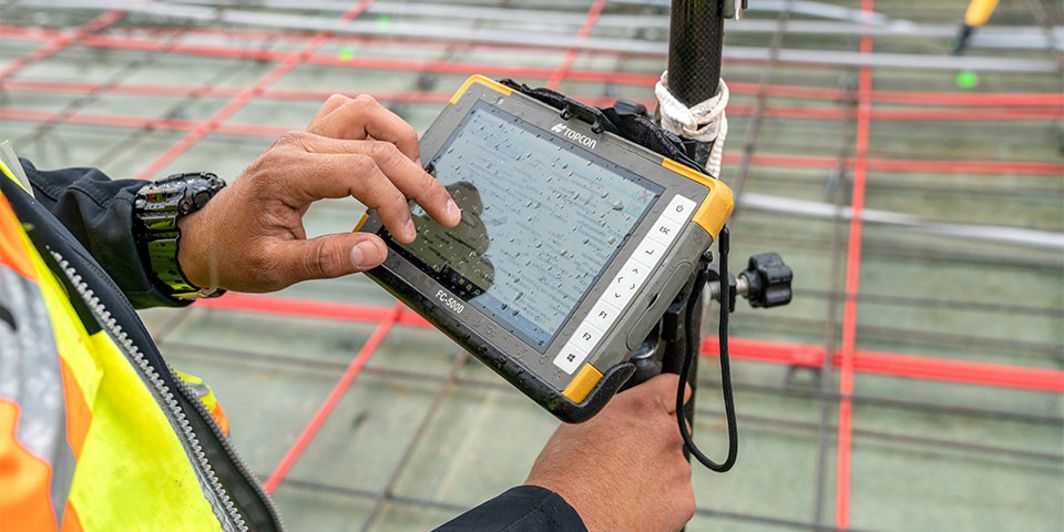
  • Use of advanced technology: With the digital transformation in the construction sector, surveyors are increasingly using advanced digital measuring tools and software, leading to more efficient and accurate surveying.
  • Flexibility and innovation: The role of the quantity surveyor is constantly evolving with technology. Their ability to adapt and integrate new methods, such as 3D scanning and advanced CAD software, makes them indispensable to the success of modern construction projects.

In short, quantity surveyors play a fundamental role in ensuring the technical accuracy and economic efficiency of construction projects. Their work ensures that projects not only meet technical specifications but are also completed on time and within budget.

The Impact of Geoinformation on Quantity Surveying

Geo-information plays a key role in the work of a quantity surveyor, particularly through the use of Geographic Information Systems (GIS). These systems enable quantity surveyors to accurately manage and analyze location-based data, which is essential for efficient and effective project execution. Here are some ways in which geoinformation influences the role of a quantity surveyor:

  • Precision and efficiency: Modern GIS platforms offer tools for accurately staking out and verifying points on the construction site. This contributes to the precision of the work and reduces the risk of costly errors during construction.
  • Data integration: Geoinformation helps integrate various datasets, which is crucial for complex construction projects. This includes topographic, structural, and environmental information, all of which are geographically localized.
  • Decision-making: With the help of geoinformation, quantity surveyors can make informed decisions based on the analysis of geographic data. This is important, for example, when determining the optimal placement of building elements or infrastructure.

The use of geoinformation has transformed the way quantity surveyors work, enabling them to perform complex measurements faster and with greater confidence. This reinforces the integral role they play in the construction industry and beyond, from road construction to water management.

Informeer & Solliciteer

Vacatures

Geo-ICT Training Center, Netherlands is a platform for entry-level professionals, those seeking career transitions, and those returning to the workforce. We train you for the role and have a variety of clients where we can help you get started. You will remain employed by us for one year, after which you may be hired directly by the clients. If you are interested, please apply for the quantity surveyor position.

Want to know more?

Do you have questions about the course content? Or are you unsure whether the course aligns with your learning goals or preferences? Would you prefer an in-house or private course? We’d be happy to help.

Opleiding

A Surveyor is proficient in the use of various CAD and GIS systems. After completing our surveying course at the Geo-ICT Training Center in the Netherlands, they are well-prepared to start working at surveying firms and construction companies. This practical training ensures that surveyors are not only theoretically knowledgeable but also immediately deployable in the field, where geoinformation and geodata are central.


Een maatvoerder gebruikt een Topcon FC-5000 tablet om metingen te verrichten op een bouwplaats. De robuuste tablet is bevestigd aan een meetinstrument en toont een digitale bouwtekening. Op de achtergrond zijn stalen wapeningsnetten en rode meetlijnen zichtbaar.

Taken

As a Surveyor, you are involved in various critical activities within construction projects. Here is a structured overview of the main tasks associated with this role:

  • Setting out dimensions: On the construction site, you use technical drawings and design specifications to determine the exact locations and dimensions of structural elements. Your duties may include, for example:
    • Positioning foundations and walls
    • Setting out pipes and formwork

    You will use various measuring instruments, such as measuring tapes, theodolites, total stations, and GPS equipment, to measure everything accurately according to the specifications.

  • Dimensioning checks: In addition to the initial layout, you perform regular checks to ensure that the constructed structural components conform to the design specifications. You report deviations promptly so that corrective actions can be taken if necessary.
  • Communication and collaboration: You work closely with other construction professionals, such as architects, engineers, contractors, and tradespeople. Effective communication and teamwork are essential for accurately conveying and executing the dimensions. You are actively involved in consultations and meetings to address any issues and propose solutions.

These tasks require in-depth knowledge of geodata and geoinformation, and highlight the versatility and importance of the role of Survey Technician in the construction sector.

Frequently Asked Questions About the Quantity Surveyor Role

A Survey Technician is responsible for performing surveying tasks on construction or infrastructure projects: measuring, staking out, and verifying points, lines, and surfaces on-site, and processing measurement data in CAD/GIS environments to ensure that construction and implementation proceed correctly.

This role is essential because accurate measurements form the foundation for the reliable execution of construction, infrastructure, or utility projects. Measurement errors can lead to delays, additional costs, or quality issues—so your work directly contributes to efficiency, quality, and safety.

At Geo-ICT, the focus is on modern and digital surveying: you’ll work with advanced surveying equipment (such as total stations and GPS/GNSS), process data digitally, and bridge the gap between fieldwork and the office using CAD/GIS tools. As a result, you’ll not only be “in the field,” but also digitally proficient in geoinformation.

Key skills include:

  • Experience with (or willingness to learn) field surveying, staking out, and measuring with instruments such as GPS/GNSS or Total Station.
  • Familiarity with CAD/GIS environments for processing survey data, and an understanding of coordinate systems and surveying principles.
  • Accuracy, good spatial awareness, and a willingness to perform outdoor and fieldwork.
  • Basic knowledge of or interest in geoinformation and digital workflows is a plus.

A typical workday might look something like this:

  • In the morning, head to the project site: set up surveying equipment, determine reference points, and measure/stake out site features.
  • Afternoon: Back at the office or site hall: processing measurement data in CAD/GIS, preparing reports, or verifying staked-out points.
  • Late afternoon: consult with the work planner or site supervisor regarding deviations, corrections, or further work. Prepare for the next day.

Yes, Geo-ICT offers training programs that prepare you for this role so you can start working right away. Check out the quantity surveyor job posting. Not sure if this is the right fit for you, but interested in working at Geo-ICT? Then our Geo-ICT Traineeship might be just what you’re looking for!

You can advance to roles such as Senior Surveyor, Surveying Work Planner, or Digital Surveying/Geo-Data Specialist. Gaining additional knowledge of surveying instruments, drones, 3D scans, BIM, or geoinformation will open up more career opportunities.

Although much of the role involves fieldwork and surveying, knowledge of geoinformation (such as GIS, geodatabases, and digital workflows) clearly adds value to this position. It makes your work more effective and enhances your employability in modern projects.

This position involves quality requirements related to accuracy (minimizing measurement errors), proper recording of measurement data, version control, and safe working conditions at the construction or project site. Documenting measurement data and collaborating with other disciplines is important.

You can apply directly for the quantity surveyor position or our Geo-ICT Traineeship, or contact us via the widget on our website by entering your name, email address, and phone number to schedule a no-obligation consultation. You can also send us a WhatsApp message. If you have any questions about the job description or whether the position is a good fit for you, please feel free to contact us.