
The role of BGT Administrator involves managing and maintaining the BGT maps
The role of BGT Administrator involves managing and maintaining the BGT maps
As a BGT Administrator, you are the key to an accurate and up-to-date digital map of the Netherlands. Your daily work is crucial, because without you, the Large-Scale Topography Database (BGT) would not be as reliable as it is today. But what exactly do you do? Let’s take a closer look:
Your work is not just a matter of entering data. It is a dynamic process in which you work closely with colleagues and external parties to ensure that the BGT provides an accurate and up-to-date picture of the Dutch topography. In addition, you are involved in advising both internal and external BGT users on the optimal use of this data.
You are not just an administrator; you are a guardian of nationally important data. The work you do impacts numerous sectors, from urban planning and development to emergency services and environmental research. Ensuring the accuracy and timeliness of the BGT is your primary mission, and every day you contribute to a better, safer, and more efficient Netherlands.
Through your dedication and expertise, the Netherlands remains at the forefront of the world of geoinformation, and you have a direct impact on how we understand and organize our living environment. Your role as a BGT Administrator is therefore indispensable for a well-functioning society.
The work of a BGT Administrator is invaluable, and its impact extends far beyond what you might think. The Large-Scale Topography Database (BGT) forms the backbone of the Netherlands’ geoinformation infrastructure. Here are a few reasons why your role as a BGT Administrator is so crucial:
Here are some specific examples of where your work makes a difference:
As a BGT Administrator, you therefore play a key role in virtually every aspect of society. From the roads we drive on to the homes we live in; your work touches the lives of everyone in the Netherlands. It ensures that the Netherlands is not only beautiful, but also safe, sustainable, and efficiently organized. And that is something to be proud of.

Do you have questions about the course content? Or are you unsure whether the course aligns with your learning goals or preferences? Would you prefer an in-house or private course? We’d be happy to help.
At the Geo-ICT Training Center in the Netherlands, every employee gains a solid foundation by taking standard CAD and GIS courses. These courses are designed to provide you with a thorough understanding of geoinformation technologies and form the basis for your further development in the field. But it doesn’t stop there. After this essential introduction, you’ll dive deeper into the world of geoinformation with the BGT Course and the BAG Course. These specialized programs are specifically designed to take your knowledge and skills to the next level, so you can contribute to projects in the geoinformation sector with confidence and expertise.
As a BGT administrator, you play a crucial role in managing the Large-Scale Topography Database (BGT), the digital map that provides a detailed representation of the Netherlands. Here are your key responsibilities, which together ensure that our geographic data is always accurate and up-to-date:
These tasks are essential for maintaining one of the most crucial tools in our geoinformation infrastructure. Your efforts ensure that everyone—from urban planners to emergency services—can rely on accurate and up-to-date geographic data.
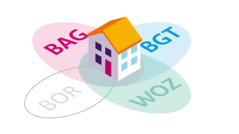
A BGT Administrator is responsible for managing and keeping the Large-Scale Topography Database (BGT) up to date. This means that you check, update, and monitor the quality of feature data—such as roads, paved surfaces, green spaces, and water bodies—and process it in the geographic information system.
This role is important because the BGT serves as the official base map for land-use planning, permitting, and infrastructure management. Through your work, you ensure that the map is reliable and that policymakers and practitioners can rely on this geodata.
At Geo-ICT, the role of BGT Administrator is unique in that you not only maintain data but also apply geoinformation techniques: you work with GIS software, perform analyses, and support BGT users within the organization.
The following skills are important for the position of BGT Administrator:
A typical workday might look like this:
Yes, Geo-ICT offers programs that will train you for this role and get you started—check out the Geo-ICT Traineeship job posting and apply today!
Although your primary responsibilities involve recording and updating map data, knowledge of geographic information technology (such as GIS, location analysis, and geographic databases) will further enhance your role as a BGT Administrator. This will enable you to interpret the data more effectively and provide better support to users.
This position is subject to quality standards such as: accurate processing of changes, compliance with established standards for the BGT, complete documentation of changes, precise geometry, reliable metadata, and reliable availability of map data.
You can apply directly for our Geo-ICT Traineeship or contact us via the widget on the page by entering your name, email address, and phone number to schedule a no-obligation conversation. You can also send us a WhatsApp message. If you have any questions about the program or whether the position is a good fit for you, please feel free to contact us.