At Geo-ICT, we understand that surveying is a broad field with many different facets. Our goal is to equip you with the knowledge and skills needed to excel in your career or area of interest within surveying. Through our wide range of courses, you can specialize in the area that interests you most or diversify your skills to become a more versatile professional. Each of our courses is designed to be practical, with plenty of hands-on experience that you can immediately apply to your work or projects. We offer courses for users, professionals, and developers.
Geodesy for Users
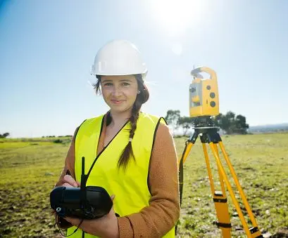
The GPS receiver and the Total Station, the most commonly used surveying instruments, are so advanced these days that anyone can learn to use them quickly. You’ll gain practical insight and context, and you’ll perform surveying with advanced instruments. For this target group, we offer the following courses:
Geodesy for Professionals
Geodesy for Developers
The Technological Evolution in Geodesy
The technological evolution in surveying is nothing short of revolutionary. Not so long ago, surveyors relied primarily on traditional instruments such as the theodolite and measuring tape. Today, however, the sector has been transformed by the introduction of GPS technology, drones, and 3D scanning. These advancements have not only significantly improved the accuracy and efficiency of surveying but have also opened the door to new applications and services.
With GPS, surveyors can now collect position data with unprecedented precision, while drones make it possible to quickly map large and hard-to-reach areas. 3D scanning, in turn, offers the ability to create detailed digital replicas of physical objects and terrain, which is essential for projects in construction and heritage preservation.
Another key development is the integration of Geographic Information Systems (GIS), which simplify the management and analysis of geographic data. These systems enable surveyors to solve complex spatial problems and support decision-making in sectors such as urban planning, environmental management, and public utilities.
These technological leaps not only mean that surveyors’ work has become faster and more accurate, but also that the role of the surveyor has evolved. Surveyors are now not only field workers, but also data analysts, problem solvers, and crucial players in the development of the modern world.
Embracing these technologies is essential for everyone in the field of surveying. That is why at Geo-ICT, we focus on offering courses that cover these new tools and methods, so you are prepared for the future of this fascinating field.
Career Opportunities in Geodesy
The world of surveying offers a wealth of career opportunities for those interested in a mix of fieldwork, technology, and solving complex spatial problems. Whether you’re passionate about nature, technology, or both, surveying has a variety of roles to offer. Some of the most in-demand positions include:
- Surveying Engineer: Responsible for planning and executing surveying projects.
- GIS Specialist: Works with geographic information systems to analyze data and create maps.
- 3D Scanning Technician: Specializes in using 3D scanning technology to capture detailed environmental data.
In addition to these specific roles, expertise in surveying opens doors to careers in:
- Project Management: Leading projects from concept to completion.
- Consulting: Advising companies and government agencies on land use and development projects.
- Research and Development: Innovating in the field of surveying techniques and technologies.
The demand for surveying experts is growing, driven by the ongoing need for accurate land surveys in construction projects, infrastructure development, and environmental management. Furthermore, rapid technological advancements in the field offer new opportunities for surveyors to develop their skills and apply them in cutting-edge applications.
Investing in a degree or course in surveying can therefore not only provide you with a solid foundation but also open the door to a career that is both challenging and rewarding. With the right skills and knowledge, you can play a crucial role in shaping our world, from mapping new developments to protecting natural and cultural heritage. The career opportunities in surveying are just as diverse and dynamic as the field itself.
Practical Applications of Surveying
Surveying is not only a fascinating field; it also has countless practical applications that influence our daily lives. Whether you’re talking about the construction of roads and bridges or the development of new residential areas, surveying plays a crucial role in planning and executing such projects. Some of the most common applications include:
- Construction and Infrastructure: Precise measurements are essential for the successful design and construction of buildings, roads, and bridges. Surveyors ensure that structures are built in the right place and according to the correct specifications.
- Real Estate and Cadastral Registration: When buying and selling real estate, accurate boundary determinations are necessary to establish property rights. Surveyors play a key role in drawing up cadastral maps and registering land ownership.
- Environmental Management and Planning: Whether mapping flood risks or planning nature conservation areas, surveyors provide the data needed to protect and sustainably manage our environment.
- Urban and Spatial Planning: The development of new urban areas or the redevelopment of existing ones requires a detailed understanding of land use. Surveyors provide the foundation for effective planning and development.
These applications demonstrate how surveying contributes to both our daily living environment and large-scale projects that shape the future of our society. It is a field that requires both technical skills and creative thinking, and where the results are often immediately visible in the world around us. By delving into surveying—whether you’re a professional or an enthusiastic amateur—you contribute to the development and preservation of our physical world.