Surveying is a field that extends far beyond the boundaries of traditional cartography and boundary demarcation. It forms the core of our modern society, where geoinformation and geodata have become indispensable. This centuries-old science is essential for surveying land and property. And it has evolved into a technologically advanced field that is closely intertwined with urban development and the planning of our living environment.
At its core, surveying is the precise determination of the physical location of points and the distances and angles between them. These points, which are usually located on the Earth’s surface, serve as the foundation for maps, property rights, and even infrastructure development. But surveying goes beyond mere measurement. It interprets and uses this data to address complex issues within geoinformation technology—from urban planning to environmental management.
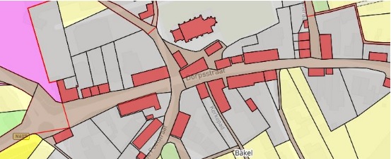
Our "Cadastral Boundary Determination" course emphasizes the practical application of these modern technologies. The course is designed to teach participants not only the fundamentals of surveying but also how to use these advanced instruments in the field. You will work with cadastral maps, historical survey fieldwork, and measurement data to determine cadastral boundaries.
Why Surveying Is Important
The importance of surveying cannot be overstated. Especially in an era where geoinformation and geodata are central to so many aspects of our daily lives. This field forms the foundation for understanding and utilizing the physical space around us. And it plays a crucial role in various sectors. Here are a few reasons why surveying is so essential:
- Accurate property demarcation: Whether it involves determining the boundaries of your own backyard or mapping large agricultural parcels, surveying provides clarity and prevents conflicts.
- Urban and spatial planning: Detailed knowledge of the land is essential for designing infrastructure. Surveyors play a key role in this process, ensuring the efficient and effective use of space.
- Environmental management and protection: Mapping natural areas helps monitor changes in the environment and plan conservation efforts. This allows us to better understand how human activities impact our planet.
Some specific applications where the knowledge and skills of surveying are indispensable include:
- Construction and development: From the initial site analysis to the final construction. Surveying ensures that projects are started on a solid foundation.
- Agriculture: Optimizing the use of farmland and water resources requires accurate measurements and analyses.
- Nature conservation: Defining protected areas and monitoring changes in these habitats is essential for preserving biodiversity.
Surveying is not just a matter of measuring. It is a way to shape, protect, and understand our world. By integrating traditional methods with modern technologies such as GIS and GPS, surveying provides us with the tools to establish legally valid cadastral boundaries, plan our cities and villages, and manage our natural resources.
The History and Evolution of Surveying
The journey of surveying through history is just as fascinating as the field itself. From the moment the first civilizations began building settlements and cultivating land, surveying was already an essential skill. This necessity led to the development of primitive yet surprisingly effective measuring instruments and techniques, which have been refined over the centuries into the advanced technologies we use today.
- Ancient civilizations: The Egyptians were among the first known surveyors, laying the foundations for this field around 3000 B.C. They developed methods to survey land for agricultural purposes and to accurately plan large-scale construction projects such as the pyramids and temples.
- Greeks and Romans: These civilizations took surveying to the next level by developing more advanced measuring instruments and methods. They used surveying for both construction projects and the establishment of property rights.
Over time, surveying evolved from simple measurement methods into a complex science that utilizes advanced technologies:
- Middle Ages: Although progress during this period was slower, surveying continued to play an important role in society.
- Renaissance: A period of scientific rediscovery and invention that gave rise to new measuring instruments and techniques.
- Modern Era: The invention of devices has radically changed the way we survey land and the precision with which we do so. Consider, for example, the theodolite, as well as GPS and GIS.
Today, surveying is a technologically advanced science that forms an integral part of virtually every construction and development project. Modern surveyors use an arsenal of high-tech equipment and software to perform measurements, including GIS, GPS, drones, and 3D scanning.
These technological advances have opened the door to new applications and possibilities within the field. As a result, surveyors play an indispensable role in society today.
What You’ll Learn in the Cadastral Boundary Determination Course
Basic Principles of Cadastral Boundary Reconstruction
Cadastral boundary reconstruction plays a crucial role in the field of surveying and geoinformation. The focus here is on accurately determining the boundaries of a parcel. This process is not only important for individual landowners who want to determine the exact boundaries of their property, but also for legal, architectural, and development purposes. Here, we delve deeper into the basic principles that underpin this process:
- Historical data and documents: One of the first steps in boundary reconstruction is collecting and analyzing historical documents and data related to the parcel. This can include old maps, previous survey records, and even historical deeds.
- Use of modern technology: Modern technologies such as GPS and GIS play a key role in the boundary reconstruction process. They enable surveyors to work with unprecedented accuracy. This reduces the likelihood of errors and increases the efficiency of the process.
- Field survey: In addition to studying documents, physical field surveys are essential. This may involve identifying old boundary stones or other physical markers that help determine the boundaries.
A well-executed cadastral boundary reconstruction takes various elements into account, such as:
- Legal frameworks: Understanding the local and national legislation applicable to land surveying and property rights is essential.
- Collaboration with professionals: The process requires the expertise of experienced surveyors who not only possess the technical skills to conduct measurements but also have a deep understanding of the legal aspects of cadastral registration.
- Communication with stakeholders: Effective communication with all parties involved is crucial.
By applying these principles, the course ensures that participants not only learn how to accurately determine cadastral boundaries, but also how to apply this knowledge in practice.
Interpretation of historical cadastral data
Historical cadastral data, often found in old documents, maps, and registers, offers invaluable insights into the past and helps determine current and future boundaries. But how do you go about interpreting this data? And why is it so important?
- Analysis of historical documents: Interpretation begins with a thorough analysis of available historical documents. These may include old cadastral maps, deeds, and other legal documents containing information about the location and boundaries of parcels.
- Verifying data: Not all historical data is equally reliable. Therefore, it is essential to verify the data using multiple sources. This may involve comparing similar information from different documents side by side to check for accuracy.
Key aspects of interpretation include:
- Understanding context: It is crucial to understand the context in which the data was created. This may relate to historical events, changes in land use, or legal amendments that have affected land ownership and boundaries.
- Technological tools: Modern technologies such as GIS (Geographic Information Systems) can be used to digitize and analyze historical data. This facilitates the visualization of old boundaries and their comparison with the current situation.
The importance of this interpretation lies in its ability to:
- Resolve boundary disputes: An accurate interpretation can help resolve boundary disputes by providing clarity on the historical location of boundaries.
- Preserve heritage: It offers a means to identify and preserve culturally and historically valuable landscapes for future generations.
- Insight into land development: It helps to understand the evolution of land use over time. This can be crucial for urban planning and environmental management.
In the world of surveying and geoinformation, technological advancements have revolutionized the way we conduct measurements and analyze data. The modern surveyor has access to an arsenal of advanced techniques and tools that enhance the accuracy, efficiency, and capabilities of their work. Let’s explore some of the most influential techniques and tools:
- GIS: GIS has become an indispensable tool for surveyors, enabling them to collect, manage, analyze, and visualize complex data. GIS technology makes it possible to map and interpret geographic data, which is essential for everything from urban planning to environmental management.
- GPS: The advent of GPS has significantly improved the precision of surveying. Using satellites, surveyors can now determine the exact location of points with unprecedented accuracy. This is particularly useful in remote or hard-to-reach areas.
In addition to these technologies, surveyors use various advanced instruments:
- Total Station: A Total Station integrates electronic distance measurement and angle measurement to accurately determine the position of points. These instruments are essential for conducting detailed land surveys and are often used in combination with GIS and GPS.
- Drones: Drones have rapidly evolved into powerful tools for surveyors. They allow surveyors to collect aerial photographs and topographic data without entering the terrain.
- 3D Scanners: This technology enables the creation of detailed three-dimensional models of objects and terrain. 3D scanners are increasingly used for documenting existing structures and planning new developments.
These modern techniques and tools not only enable surveyors to perform their work with greater precision and efficiency, but also open the door to new applications and services.
Why choose our Cadastral Boundary Determination Course?
Choosing a surveying course is an important decision that can shape your career and take your skills to the next level. At Geo-ICT Training Center, we understand the value of high-quality education and offer a course that not only meets the theoretical and practical requirements of the field but also provides unique benefits you won’t find anywhere else. Here are a few reasons why our course is the right choice for you:
- In-depth and hands-on learning experience: Our course goes beyond just teaching theory. We ensure you gain hands-on experience with the latest surveying equipment and technologies, such as GIS, GPS, and drones. This means you not only learn the techniques but also put them into practice.
- Instruction from experts in the field: Our instructors are not only academically qualified but also have extensive experience in surveying. They bring real-world experiences and insights into the classroom, bringing the subject matter to life and preparing you for what you’ll encounter in the field.
- A wide range of applications: The skills you gain in this course are applicable across a wide range of sectors—from construction and real estate to environmental and urban planning. This opens the door to diverse career opportunities.
Choosing the "Cadastral Boundary Determination" course at Geo-ICT Training Center means investing in your future. Not only will you be immersed in the geoinformation and geodata that are indispensable in many professional fields today, but you’ll also have the opportunity to learn from and network with professionals who are already successful in the field.