
Using the MOVE3D package, participants learn how to perform surveying calculations and adjustments.
Geodesie
Using the MOVE3D package, participants learn how to perform surveying calculations and adjustments.
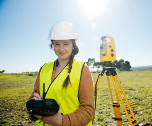 Surveying, a field that is both an art and a science, plays a crucial role in the development of our living environment. It involves determining the three-dimensional positions of points and the distances and angles between them, usually on the Earth’s surface. These techniques are not only fundamental for establishing maps and property boundaries, but also for positioning architectural elements in structures and mapping the location of underground features. In this field, a surveyor combines knowledge of geodesy, geometry, trigonometry, and law, and uses advanced equipment such as total stations, theodolites, and GNSS receivers, as well as specialized software.
MOVE3D plays a key role in modern surveying; it is an advanced software for the processing and quality control of surveying measurements. MOVE3D enables professionals to explore and adjust geodetic networks in 3D, 2D, and 1D, fully in line with the Delft point determination theory. This makes it an indispensable tool for anyone working with surveying and geodata analysis. By integrating MOVE3D into surveying projects, a new level of precision and efficiency is achieved, which is crucial for both the planning and execution of construction projects and the management of geographic information.
Professionals such as those at Geoservice Landmeetkunde translate this centuries-old knowledge into practical solutions for today’s challenges. With an emphasis on accuracy and quality, they carry out surveying work using the most advanced techniques and equipment, including MOVE3D. Their services cover a wide range of surveying projects, from cadastral surveys and elevation surveys to verification surveys and the mapping of utility lines, at every stage of construction or development, on land or water, always striving for an affordable, customized partnership.
This course includes many exercises in which you will process and adjust a number of practical measurements. Prior completion of our Surveying Course is recommended.
Surveying, a fascinating combination of science and technology, focuses on measuring and mapping the Earth’s surface. This field plays an essential role in everything from determining national borders to planning urban infrastructure and designing buildings. Modern surveyors use a range of advanced tools, including:
Not only the physical measurement, but also the conversion of these measurements into usable geoinformation is part of a surveyor’s duties. Due to automation and technological advancements, surveying has evolved significantly over the past decades, with methods such as photogrammetry, scanning, and 3D modeling becoming increasingly important.
At its core, surveying remains indispensable for a wide range of applications, from establishing property boundaries to supporting large-scale construction projects and urban planning.
The role of technology in modern surveying has become crucial, with MOVE3D serving as a prime example of this progress. This software package, specialized in the processing and quality control of surveying measurements, illustrates the significant impact of digital tools on the field. Key technological developments include:
Thanks to these technological advances, surveyors can now work with unprecedented precision, which is essential for numerous applications in construction, urban planning, and environmental management. The integration of these modern tools not only transforms the way surveyors work but also increases the value of geoinformation in our society.
A fundamental aspect of surveying, and central to the MOVE3D software, is the understanding of geodetic adjustment techniques. These techniques are essential for:
MOVE3D plays a key role in this by offering advanced calculation methods that help surveyors efficiently process their data. This not only improves the quality of the geoinformation but also supports complex surveying projects.
Developing proficiency in using MOVE3D software is crucial for modern surveyors who strive for precision in their projects. MOVE3D enables users to efficiently process and analyze complex surveying data, which is essential for:
Given the complexity of modern surveying projects, expertise in such software is not just an asset but a necessity for professionals working with geodata. It provides a strong foundation for performing advanced analyses and making informed decisions.
The use of MOVE3D for precise point determination is a game-changer in surveying. This powerful tool enables surveyors to:
Thanks to MOVE3D, surveyors and geoinformation specialists can work with confidence on projects that demand extreme precision, from metropolitan developments to nature conservation initiatives.
Our MOVE3D course stands out due to several key factors that make our offering unique:
By choosing our course, you are making a valuable investment in your professional development within the world of surveying and geoinformation.

Do you have questions about the course content? Or are you unsure whether the course aligns with your learning goals or preferences? Would you prefer an in-house or private course? We’d be happy to help.
The Move3D Course is a two-day training program designed to teach participants how to use MOVE3 software for surveying calculations, including 3D, 2D, and 1D geodetic networks. It is ideal for both beginners and experienced professionals in the geosector.
This course is designed for a wide range of professionals, including entry-level geospecialists, experienced geoprofessionals, employees of companies in the geosector, career changers, and educational institutions looking to expand or refresh their knowledge of MOVE3 software.
In the Move3D course, you will learn about geodetic adjustment using the least-squares method, Delft point determination theory, quality control, and the use of MOVE3 software for triangulation and trilateration.
The Move3D Course is an intensive two-day training program in which participants learn to perform surveying calculations and adjustments using MOVE3. This includes surveying and adjusting 3D, 2D, and 1D geodetic networks, as well as applying the Delft point determination theory.
The course lasts two days. On the first day, participants learn about MOVE3D, how to process measurements, and how to evaluate results. The second day is more hands-on, featuring exercises in which participants process and analyze real-world measurements.
The course aims to develop a thorough understanding of geodetic adjustment techniques, proficiency in using MOVE3D for geodetic adjustment, and the application of MOVE3D for precise point determination in geodetic projects.
Yes, the Surveying Course is recommended as a prerequisite. This helps students gain a better understanding of and a solid foundation in the complex topics covered in the Move3D Course.
After the course, participants will have two more weeks to ask the instructor questions via email.
The course is held in person, with the option to participate online. The course runs from 9:00 AM to 4:00 PM. For in-person participants, coffee, tea, lunch, and a laptop will be provided. Online participants will take the course via Google Meet.
Yes, Geo-ICT Training Center offers the option of delivering the course on-site. The instructor will come to your location with laptops for the participants. Companies or organizations can email us with their requirements to receive a quote and schedule the course.