Surveying, an essential discipline within geoinformation technology, forms the basis for accurately determining geographic positions on Earth. By combining theoretical knowledge with practical applications, surveying enables professionals to perform complex measurements and analyses, which are essential for various sectors such as construction, infrastructure, and environmental management. Modern GPS technologies and Total Stations have significantly improved the accessibility and precision of surveying, allowing even beginners to become productive in this field. However, a thorough understanding of the theory behind these technologies remains crucial for correctly interpreting and applying the data obtained.
Geo-ICT, the integration of geodesy and ICT, has transformed the application of geoinformation in our daily lives. It provides tools and techniques for collecting, analyzing, and sharing geodata, which is indispensable for making informed decisions about our spatial environment. The Surveying Course at Geo-ICT offers a unique opportunity to master both the theoretical foundations and the practical skills of surveying, with a focus on applying this knowledge in the geoinformation sector. By learning to work with GPS, Total Stations, AutoCAD, and QGIS, you will develop the necessary skills to contribute to the planning and management of our living environment.
The Importance of Theoretical Knowledge
Theoretical knowledge in surveying is like the foundation of a building: essential for stability and sustainability. An understanding of the principles of geodesy—the science of measuring and representing the Earth—is crucial for every surveyor. This understanding enables you to perform measurements correctly, analyze data accurately, and deliver reliable results. Without this knowledge base, the use of advanced equipment such as GPS and Total Stations would be reduced to guesswork. In the Surveying program at Geo-ICT, you will not only learn practical skills but also delve deeply into the theory behind the practice. This ensures that you not only know how to do something but, more importantly, why it must be done that way. This deeper understanding is what distinguishes a good surveyor from someone who simply operates the controls.
Practical Applications in the Field
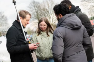
Applying your knowledge in the field is what brings the theory to life. Surveying is not just a matter of technique, but also of insight and adaptability. Here are some key areas where you will develop practical skills:
- Use of GPS technologies: for accurate positioning and mapping.
- Application of Total Stations: for detailed measurements of distances, angles, and elevations.
- Data analysis and interpretation: converting raw data into usable information.
These skills enable you to work on a variety of projects, ranging from construction and infrastructure projects to environmental management and spatial planning. By combining your theoretical knowledge with practical experience, you will become an indispensable link in any project where geodata plays a role. Geo-ICT offers you the opportunity to develop these skills in a supportive and practice-oriented learning environment, preparing you for the challenges and opportunities in the field of geoinformation.
What will you learn in our Land Surveyor program
Working with modern GPS receivers and Total Stations
In modern surveying, modern GPS receivers and Total Stations play a crucial role. These advanced instruments enable surveyors to work with unmatched precision. GPS receivers use satellite signals to obtain exact location data, essential for projects where geographic accuracy is of the utmost importance. Total Stations, on the other hand, offer the ability to measure both distances and angles with high precision, making them indispensable for conducting detailed topographic surveys and construction site measurements.
Mastering these technologies is not just a matter of learning how to operate the equipment; it also requires a deep understanding of how these instruments integrate with software and how the collected data is analyzed and interpreted for practical applications. Geo-ICT’s Surveying training places a strong emphasis on both the theory and practice of these modern surveying instruments, teaching you how to effectively deploy these tools in a wide range of surveying projects.
Theoretical foundations and practical skills
The Surveying course at Geo-ICT is a unique blend of theory and practice, aimed at providing a thorough foundation in surveying and applying this knowledge in real-world scenarios. You’ll get an in-depth look at the theoretical foundations essential for every geo-professional, covering topics such as:
- Geodetic principles: understanding the Earth’s shape and size.
- Surveying and cartography: accurately recording and analyzing geographic data.
Combined with practical skills through the use of:
- Modern surveying instruments: such as GPS, Total Stations, AutoCAD, and QGIS.
- Project applications: from planning and conducting land surveys to processing the data.
This approach ensures that you are equipped not only with the knowledge of how things work, but also with the “why” behind the techniques and technologies, preparing you for a wide range of challenges in the geoinformation world. With our course, you’ll build a solid foundation that enables you to enter the field with confidence and expertise.
Why choose our Surveying program?
Choosing Geo-ICT’s surveying training is a choice for quality, innovation, and practical applicability. We distinguish ourselves through:
- Expert instructors: Our instructors are experts in their field with years of experience in both teaching and the practice of surveying.
- Modern technologies: We utilize the latest GPS and Total Station technologies, so you learn with the equipment you’ll use in the field.
- Practical learning experience: Our course is designed to provide you not only with theoretical knowledge but also extensive hands-on experience.
By focusing on both the fundamentals of surveying and the latest technological developments, our course prepares you for a successful career in the geoinformation industry. You’ll learn not only “how” but also “why,” enabling you to develop the in-depth understanding essential for every professional.