


GIS (Geographic Information System) is used to collect, analyze, and visualize geographic data. In emergency response, it helps responders map disaster areas, plan evacuation routes, and coordinate rescue operations more efficiently.
When disaster strikes, every second counts. With GIS (Geographic Information System), emergency services can respond faster and make better decisions thanks to real-time geodata. Whether it’s floods, earthquakes, or wildfires, GIS immediately maps the situation and helps save lives. In this blog, you’ll discover how GIS and emergency response come together in practice, supported by inspiring examples such as the work of HOTOSM and UNOSAT.
By gathering data from various sources—such as satellite imagery, drones, and sensors—and combining it, we can create an up-to-date and accurate picture of the crisis.
Using GIS, emergency services can:
During disasters, situational awareness is crucial. GIS helps quickly assess the scale and impact of a disaster. Consider drones transmitting real-time images of flooded areas, or satellite data showing which routes are still passable. Thanks to these insights, rescue teams can act faster and more safely.
One of the best-known examples of GIS applications in emergency relief is the work of the Humanitarian OpenStreetMap Team (HOTOSM)![]()
When a disaster strikes anywhere in the world—such as an earthquake or flood—thousands of volunteers come together to map the affected areas via OpenStreetMap. Within a few hours, up-to-date maps featuring roads, buildings, and relief centers are created. Aid organizations such as the Red Cross and Doctors Without Borders use this data directly in their GIS systems to plan rescue operations and coordinate logistics.

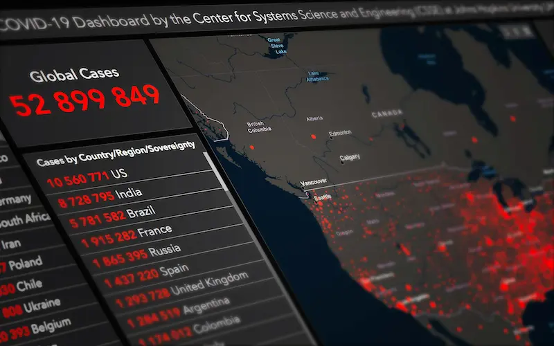
International agencies such as UNOSAT (United Nations Satellite Centre) also use GIS technology to conduct damage assessments via satellite imagery and support emergency relief efforts. During the 2015 earthquake in Nepal, UNOSAT provided local authorities with maps containing accurate damage assessments within 24 hours.

In addition, drones and sensor data are used worldwide for real-time monitoring—for example, during wildfires in Australia, where GIS data helps predict the spread of fire and designate safe evacuation zones.
These real-world examples demonstrate the power of GIS in action: from crowdsourced mapping to advanced satellite analysis—all focused on a single goal: responding faster and saving more lives.
GIS is not only used during emergencies, but also plays a key role in long-term disaster management. By identifying risks in advance, vulnerable areas can be better prepared.
Using risk analyses based on GIS data, governments and organizations can take preventive measures. Examples include simulating flood scenarios, earthquakes, or wildfires. This enables policymakers to plan more effectively and protect citizens.
The role of GIS continues to evolve thanks to technological innovations.
Drones provide detailed aerial images of disaster areas, even in places where people cannot go. Satellites, in turn, offer a large-scale overview, ideal for planning large-scale rescue operations.
AI analyzes vast amounts of geodata and can identify patterns that humans overlook. This helps predict disasters and improve emergency plans.
GIS and emergency response are inextricably linked. Whether it involves real-time decision-making during a disaster or long-term preventive planning, GIS makes emergency response faster, smarter, and more effective.
Thanks to technological innovations, GIS will play an even greater role in emergency response and disaster management in the future. This makes it an indispensable tool for any organization dedicated to safety and crisis management.

GIS (Geographic Information System) is used to collect, analyze, and visualize geographic data. In emergency response, it helps responders map disaster areas, plan evacuation routes, and coordinate rescue operations more efficiently.
Geodata refers to factual data with a geographic component (such as coordinates or maps). GIS is the system that processes this geodata and makes it accessible for decision-making, for example during disasters or crisis situations.
GIS can be used to identify risks in advance, such as areas prone to flooding or earthquakes. Governments use this information to implement preventive measures and optimize emergency plans.
A good example is the Humanitarian OpenStreetMap Team (HOTOSM), in which volunteers around the world map disaster-stricken areas. These maps help organizations such as the Red Cross to provide aid quickly.
GIS is often combined with drones, satellite imagery, and artificial intelligence (AI). Together, these technologies provide real-time information about the situation on the ground.
We offer a variety of GIS courses, ranging from beginner to advanced levels. These are ideal for professionals who want to learn how GIS is used in emergency response, disaster management, or other applications.
You can work as a GIS specialist or GIS operator through us! If you’re not yet sure which specific path you want to take but would like to work in the Geo-ICT field, our Geo-ICT traineeship might be just the thing for you!