
This course is intended for employees who want to learn how to use QGIS for AERIUS nitrogen calculations.
Everything about QGIS
This course is intended for employees who want to learn how to use QGIS for AERIUS nitrogen calculations.
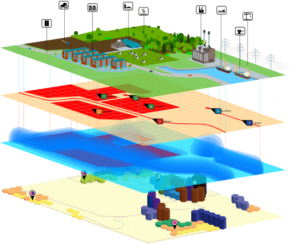 In the world of geoinformation and environmental assessments, Geographic Information Systems (GIS) are a crucial pillar. GIS enables us to visualize, analyze, and interpret data to understand relationships, patterns, and trends in the form of maps, graphs, and reports. These systems are not only indispensable for geographers and urban planners, but they also play a key role in air quality modeling. Combining location data with environmental data offers unprecedented opportunities for assessing and managing the impact of human activities on the air we breathe.
QGIS, an open-source GIS software, makes this field accessible to a broad audience. From mapping urban air quality to modeling the dispersion of pollutants at the national level, QGIS provides the tools needed to analyze complex geodata and generate insights that are crucial for sustainable development and environmental protection. The integration of Aerius software into QGIS further enhances these capabilities by offering specific tools for nitrogen deposition and air quality analyses, which is essential for projects in the Netherlands where the effects of nitrogen are a key assessment criterion.
For professionals working on projects related to spatial planning, environmental management, and infrastructure development, the QGIS Aerius Course at Geo-ICT offers a unique opportunity to gain in-depth knowledge and skills in using these powerful tools. Geo-ICT distinguishes itself through its practical approach and commitment to sharing knowledge and expertise in geoinformation technologies, enabling students to not only learn about the theory behind GIS and air quality modeling but also how to apply this knowledge in real-world scenarios.
Are you not yet familiar with QGIS? Then we recommend the QGIS Basic Course!
Geographic Information Systems (GIS) are more than just software for creating maps; they are powerful tools that help us understand and influence the world around us. At its core, GIS combines location data with various layers of information, enabling complex analyses and visualizations that provide insight into spatial patterns and relationships. This is crucial in virtually every sector where location plays a role—from urban planning and environmental management to public health and retail.
But why is GIS so important? First, it enables us to make better decisions. Whether it involves planning new infrastructure, assessing environmental risks, or optimizing logistics routes, GIS assists decision-makers by providing accurate, up-to-date, and spatially relevant information. Second, GIS promotes a better understanding of spatial patterns and relationships, allowing us to address complex issues such as climate change, urban development, and natural disasters more effectively.
The integration of GIS into air quality modeling is a perfect example of its value. By combining location-based data with environmental measurements, we can identify sources of air pollution, predict the dispersion of pollutants, and assess the impact on public health. This is not only essential for developing effective environmental policies but also for protecting the health of communities worldwide.
At a time when the need for sustainable solutions is becoming increasingly urgent, GIS offers an indispensable set of tools. It enables us not only to view and analyze geodata, but also to understand and use it for the well-being of our planet and its inhabitants. The QGIS Aerius course at Geo-ICT is your gateway to this fascinating world, where every data point tells a story and every map can be the key to a better future.
Air quality modeling plays an essential role in the field of environmental assessment, a discipline focused on predicting and evaluating the impact of human activities on the environment, including the air we breathe. Using advanced software tools such as Aerius, which is specifically designed for nitrogen deposition analyses, experts can map the dispersion of pollutants, assess the impact on sensitive natural areas, and develop strategies to minimize these effects.
These modeling processes are not only crucial for compliance with environmental laws and policies, but they also provide indispensable insights for urban planners, developers, and environmental experts. By integrating geospatial data with air quality data, these professionals can accurately predict and assess the effects of proposed projects on air quality and, where necessary, take measures to prevent or mitigate negative consequences.
Moreover, air quality modeling enables us to act proactively. Instead of reacting to environmental challenges after they arise, we can use these technologies to anticipate and prevent potential problems. This is particularly important in the era of climate change, where pressure on natural resources and ecosystems is increasing.
In the QGIS Aerius Course at Geo-ICT, you will not only learn how to use this powerful modeling software, but you will also gain insight into the principles of environmental assessment and the ways in which data analysis can contribute to more sustainable development projects. This makes the course particularly valuable for anyone involved in the planning and implementation of projects with a potential impact on air quality and the natural environment.
By acquiring the knowledge and skills needed to make data-driven decisions, as a Geo-ICT student, you’ll be well-equipped to contribute to creating healthier living environments and protecting our planet for future generations.
The path to mastery in QGIS begins with a solid understanding of the fundamentals: how to visualize, analyze, and manipulate data within this powerful open-source software. But to truly unlock the power of geoinformation, it is essential to go beyond the basics. The QGIS Aerius Course at Geo-ICT is designed not only to teach you the fundamentals but also to guide you through the advanced techniques needed to perform complex geodata analyses and air quality modeling.
Whether you’re new to the world of GIS or looking to expand your existing skills, this course offers a hands-on approach to exploring QGIS. You’ll learn how to process spatial data efficiently, how to apply advanced cartographic principles to create insightful maps, and how to perform data analysis that forms the basis for effective decision-making and environmental management.
In addition, you will delve deeper into the integration of Aerius software within QGIS, an essential skill for anyone involved in environmental assessment and planning in the Netherlands. This knowledge will enable you to perform accurate calculations for nitrogen deposition, a critical element in the assessment of projects with a potential impact on natural habitats.
Thanks to Geo-ICT’s hands-on approach, you will not only learn about the theory behind these processes but also have the opportunity to work directly with the software on realistic project scenarios. This ensures that you leave the course not only with a deep understanding of QGIS and Aerius but also with the skills to apply these tools effectively in your professional life.
Mastering both the fundamentals and advanced techniques of QGIS opens up a world of possibilities for geoinformation professionals. Whether managing urban development projects, conducting environmental impact assessments, or contributing to sustainability initiatives, the skills you gain at Geo-ICT will be a valuable part of your toolkit.
Aerius Software plays a fundamental role in the world of environmental assessment and nitrogen calculations in the Netherlands. This software is designed to perform precise analyses of nitrogen deposition on natural habitats, an issue of great importance given strict environmental legislation and the need to protect biodiversity. Aerius is widely recognized and used by professionals involved in spatial planning, environmental consulting, and public policy, and is central to the QGIS Aerius Course offered by Geo-ICT.
By integrating Aerius into QGIS, one of the most popular open-source GIS platforms, users can analyze the impact of projects on air quality—and specifically nitrogen deposition—with unprecedented accuracy. This integration offers a powerful combination of tools for geodata analysis and environmental assessment, essential for developing sustainable solutions that meet both local and national environmental standards.
Using Aerius within QGIS enables you to navigate the complexities of environmental impact assessments and provides a clear understanding of how proposed developments might affect the delicate balance of our natural environment. Whether it involves the construction of new roads, the expansion of agricultural activities, or the development of residential projects, the combination of these software tools offers an invaluable source of insight and guidance.
In the course at Geo-ICT, you will not only learn how to effectively use the Aerius software within QGIS, but also the theoretical foundations underlying nitrogen modeling and environmental assessment. This prepares you to make informed decisions that contribute to both economic development and the preservation of our environment.
Mastering these tools through the QGIS Aerius Course opens up a world of possibilities for professionals committed to developing projects that respect nature and meet today’s strict environmental requirements. With the knowledge and skills acquired at Geo-ICT, you’ll become a valuable player in the fight for a more sustainable future.
When you decide to delve into geoinformation and environmental assessment, it is essential to choose a program that offers not only in-depth theoretical knowledge but also practical skills that can be immediately applied in the field. The QGIS Aerius Course at Geo-ICT stands out for several reasons as the optimal choice for professionals and enthusiasts in this field. Here are some key points that set our course apart:
By choosing our course, you’re investing in a learning experience that goes beyond the basics. You’ll gain skills you can apply immediately and that will help you excel in your career. Some of the unique benefits of our course include:
Choosing the QGIS Aerius Course at Geo-ICT means choosing a future where you’re equipped with the knowledge and tools to make a difference. Whether you want to take your career to the next level, expand your skills, or contribute to important environmental issues, our course provides you with the foundation you need.
Preparing data
Import the nitrogen deposition data into QGIS. This can be in the form of CSV files, Excel spreadsheets, or direct outputs from AERIUS. Make sure you also have the underlying geographic maps, such as topographic maps, cadastral data, or satellite imagery
Linking data
Link the nitrogen deposition data to the geographic locations. This can be done using coordinates or a common field (such as area name or ZIP code).
Visualization
Use the symbolization and style options in QGIS to visualize the nitrogen deposition data. This can be done, for example, using color-coded points, lines, or polygons that represent the intensity of nitrogen deposition. Consider using a color scale that clearly shows the different levels of nitrogen deposition.
Analysis and Interactive Features
Use QGIS features such as the "Identify Tool" to view specific data on nitrogen deposition at specific points or areas. If necessary, apply spatial analyses, such as buffering or intersection, to investigate the impact of nitrogen deposition on certain areas.
Map Creation
Create a final map with all relevant information, such as a legend, scale, and any annotations that clarify the map. Ensure the map is readable and informative, with a clear title and source citation.
Exporting and Sharing:
Export your final map as an image or PDF for reporting or presentation purposes. Consider sharing the map as an interactive web map if you want to make your data and results widely available.

Do you have questions about the course content? Or are you unsure whether the course aligns with your learning goals or preferences? Would you prefer an in-house or private course? We’d be happy to help.
QGIS Aerius is a specialized course offered by the Geo-ICT Training Center, focused on geographic information and air quality modeling. It is important because it provides participants with the skills and knowledge needed to excel in the geospatial sector.
The QGIS Aerius course covers topics such as geographic information, air quality modeling, Aerius software, and spatial analysis. It provides participants with a comprehensive knowledge base.
Yes, you can register for the QGIS Aerius course using the registration form at the top of this page.
Yes, after successfully completing the QGIS Aerius course, we offer internships that allow you to apply what you’ve learned in a real-world setting. It’s a great opportunity to gain practical experience in the geospatial sector.
Yes, we offer special discounts and corporate packages for companies in the geospatial sector that wish to enroll multiple employees in the QGIS Aerius course. Please contact us for more information.
Upon successful completion of the QGIS Aerius course, you will receive an official certificate from the Geo-ICT Training Center in the Netherlands.
To participate in the QGIS Aerius course, you must have a computer with internet access. We will provide you with the necessary software licenses during the course.
Yes, we provide full support and guidance throughout the QGIS Aerius course. Our experienced instructors are here to help you with any questions you may have.
Yes, we also offer online and distance learning options for the QGIS Aerius course, allowing you to study flexibly from home.